IMAGES TAKEN NEAR TO
Westside Gardens, MAUCHLINE, KA5 5DJ
Introduction
This page details the photographs taken nearby to Westside Gardens, KA5 5DJ by members of the Geograph project.
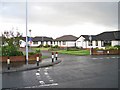
The Geograph project started in 2005 with the aim of publishing, organising and preserving representative images for every square kilometre of Great Britain, Ireland and the Isle of Man.

There are currently over 7.5m images from over14,400 individuals and you can help contribute to the project by visiting https://www.geograph.org.uk
Image Map (61 Images)
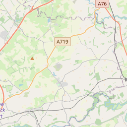
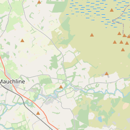


Leaflet Map data © OpenStreetMap
Images are licensed for reuse under creativecommons.org/licenses/by-sa/2.0
Notes
- Clicking on the map will re-center to the selected point.
- The higher the marker number, the further away the image location is from the centre of the postcode.
Image Listing (61 Images Found)
Images are licensed for reuse under creativecommons.org/licenses/by-sa/2.0
Image
Details
Distance
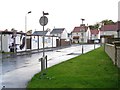
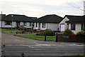
1
Westside Gardens, Mauchline
A small cul-de-sac of bungalows off the Ayr Road.
Image: © Richard Dorrell
Taken: 29 Sep 2012
0.02 miles
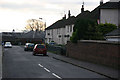
2
Residential housing
Leaving Mauchline to the south west along the B734, there is a mixture of red sandstone terraced housing and newer private housing areas.
Image: © Bob Forrest
Taken: 23 Dec 2006
0.03 miles
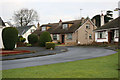
3
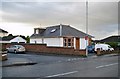
Unusual B&B
What appears at first glance to be a small suburban bungalow on the corner of West Park Avenue, Mauchline, has a large first floor extension to the rear which provides comfortable and spacious bed and breakfast accommodation.
Image: © Richard Dorrell
Taken: 29 Sep 2012
0.04 miles
4
New housing development, Mauchline
Named Netherplace, after the mansion house which once stood nearby (demolished in the 1960s) this modern housing development of 38 three and four-bedroom detached houses and bungalows is nearing completion.
Image: © Richard Dorrell
Taken: 29 Sep 2012
0.06 miles
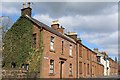
5
Council Housing
A council housing area dating from around the 1950 period which lies between Barskimming Road and the B743. It lies behind older red sandstone terraced cottages and semi detached villas.
Image: © Bob Forrest
Taken: 23 Dec 2006
0.06 miles
6
Clarinda Crescent
Entrance to a private housing development which has been built on land formerly belonging to Netherplace House. The houses date from around the mid 1960 period.
Image: © Bob Forrest
Taken: 23 Dec 2006
0.09 miles
8
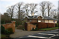
Lodge house
One of the lodge houses at the entrance to the drives leading to the former Netherplace mansion. This lodge has recently been renovated while maintaining its former character.
Image: © Bob Forrest
Taken: 23 Dec 2006
0.10 miles
9
Private residential housing
A private detached housing development dating from the latter years of the 20th century. It has direct access on to the B743 road to Ayr.
Image: © Bob Forrest
Taken: 23 Dec 2006
0.11 miles
10
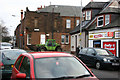
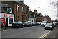
Loudoun Street, Mauchline
This is the main shopping area in the village and is part of the B743 which links Mauchline to the town of Ayr. Traffic congestion can be a problem in what is one of the original streets in the village.
Image: © Bob Forrest
Taken: 23 Dec 2006
0.11 miles