IMAGES TAKEN NEAR TO
Craighall Road, KILMARNOCK, KA3 6GN
Introduction
This page details the photographs taken nearby to Craighall Road, KA3 6GN by members of the Geograph project.
The Geograph project started in 2005 with the aim of publishing, organising and preserving representative images for every square kilometre of Great Britain, Ireland and the Isle of Man.

There are currently over 7.5m images from over14,400 individuals and you can help contribute to the project by visiting https://www.geograph.org.uk
Image Map
Images are licensed for reuse under creativecommons.org/licenses/by-sa/2.0
Notes
- Clicking on the map will re-center to the selected point.
- The higher the marker number, the further away the image location is from the centre of the postcode.
Image Listing (7 Images Found)
Images are licensed for reuse under creativecommons.org/licenses/by-sa/2.0
Image
Details
Distance
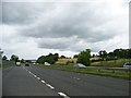
1
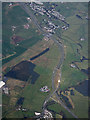
Roads at Fenwick from the air
The north tip of Kilmarnock is in the foreground, Fenwick is in the distance. The M77 motorway from Glasgow becomes the A77 at this point.
Image: © Thomas Nugent
Taken: 17 Apr 2017
0.06 miles
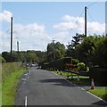
2
Country road towards Rowallan Castle
Leaving the northern outskirts of Kilmarnock.
Image: © Alan Reid
Taken: 8 Feb 2017
0.11 miles
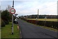
3
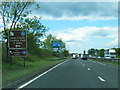
Roadworks ahead
Approaching three way traffic lights and construction work on Glasgow Road, Kilmarnock.
Image: © Richard Webb
Taken: 25 Sep 2015
0.15 miles
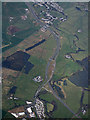
4
Roads at Fenwick from the air
Looking at this view on an OS 50K map http://www.geograph.org.uk/article/OS-Symbols---Roads-and-paths , you will see roads of all colours; blue (M77 motorway), green (A77 primary route), red (A77 main road), brown (various B class), yellow (minor) and white (unclassified).
Image: © Thomas Nugent
Taken: 17 Apr 2017
0.16 miles
6
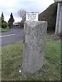
Old Milestone by the B7038, Glasgow Road, Kilmarnock
Ayr granite by the B7038, in parish of Kilmarnock (East Ayrshire District), North end of Kilmarnock, at roundabout, by entrance to Hillcrest, East side of road.
Inscription reads:- : Kilmarnock / 2 : : Glasgow / 19 :
Surveyed
Milestone Society National ID: AYE_KMGW02
Image: © Milestone Society
Taken: Unknown
0.20 miles