IMAGES TAKEN NEAR TO
KILMARNOCK, KA3 6BW
Introduction
This page details the photographs taken nearby to KA3 6BW by members of the Geograph project.
The Geograph project started in 2005 with the aim of publishing, organising and preserving representative images for every square kilometre of Great Britain, Ireland and the Isle of Man.

There are currently over 7.5m images from over14,400 individuals and you can help contribute to the project by visiting https://www.geograph.org.uk
Image Map
Images are licensed for reuse under creativecommons.org/licenses/by-sa/2.0
Notes
- Clicking on the map will re-center to the selected point.
- The higher the marker number, the further away the image location is from the centre of the postcode.
Image Listing (5 Images Found)
Images are licensed for reuse under creativecommons.org/licenses/by-sa/2.0
Image
Details
Distance
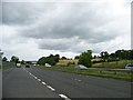
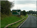
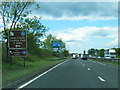
4
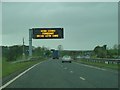
A77 at Assloss
After travelling over 70 miles through the Galloway Hills on a journey to Glasgow with wind speeds in Scotland over the 100mph mark it came as quite a surprise to see this information sign on the A77 that "high winds were forecast". They'd already arrived and we'd driven through them past many fallen trees and debris on the road. Some of the worst wind conditions every experienced in Scotland happened today and continued through the night. Well, I suppose that at least the signs didn't display their usual messages of "Remember to check your tyres" and "Fill your windscreen water bottle". We should be thankful for small blessings.
Image: © Andy Farrington
Taken: 23 May 2011
0.17 miles
5
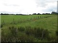
Field, Borland
There is so much more to this square than a windscreen. One of a few fields hereabouts grazed by sheep.
Image: © Richard Webb
Taken: 13 Aug 2014
0.20 miles