IMAGES TAKEN NEAR TO
KA3 4EZ
Introduction
This page details the photographs taken nearby to KA3 4EZ by members of the Geograph project.
The Geograph project started in 2005 with the aim of publishing, organising and preserving representative images for every square kilometre of Great Britain, Ireland and the Isle of Man.

There are currently over 7.5m images from over14,400 individuals and you can help contribute to the project by visiting https://www.geograph.org.uk
Image Map
Images are licensed for reuse under creativecommons.org/licenses/by-sa/2.0
Notes
- Clicking on the map will re-center to the selected point.
- The higher the marker number, the further away the image location is from the centre of the postcode.
Image Listing (13 Images Found)
Images are licensed for reuse under creativecommons.org/licenses/by-sa/2.0
Image
Details
Distance
2
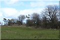
Brick Shelter
Shelter in field off single track road. Substantial structure being brick built with concrete roof. No obvious use. Glasgow to Ardrossan rail line was located a few hundred metres west of the location so may have been associated with the railway. 9th April 2010 11.40am.
Image: © Gordon Dowie
Taken: 9 Apr 2010
0.15 miles
3
Signal on Kilmarnock to Barrhead Line
An old fashioned railway signal. Taken from the A736 Lugton to Barrhead road.
Image: © wfmillar
Taken: 13 Nov 2009
0.16 miles
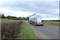
4
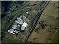
Mclaren's Nurseries from the air
Next to Caldwell Golf Club, near Uplawmoor on the A736 Lochlibo Road.
Web site: https://www.mclarensnurseriesltd.co.uk/ .
Image: © Thomas Nugent
Taken: 27 Mar 2022
0.18 miles

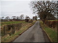
6
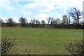
Farmland near Lugton
With steps up to the railway.
Image: © Billy McCrorie
Taken: 25 Apr 2016
0.18 miles
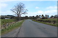
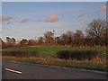
10
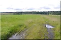
Farm track, Caldwell
There is a wetland area beyond the field.
Image: © Richard Webb
Taken: 9 Sep 2017
0.21 miles