IMAGES TAKEN NEAR TO
Windsor Gardens, LARGS, KA30 9DN
Introduction
This page details the photographs taken nearby to Windsor Gardens, KA30 9DN by members of the Geograph project.
The Geograph project started in 2005 with the aim of publishing, organising and preserving representative images for every square kilometre of Great Britain, Ireland and the Isle of Man.

There are currently over 7.5m images from over14,400 individuals and you can help contribute to the project by visiting https://www.geograph.org.uk
Image Map
Images are licensed for reuse under creativecommons.org/licenses/by-sa/2.0
Notes
- Clicking on the map will re-center to the selected point.
- The higher the marker number, the further away the image location is from the centre of the postcode.
Image Listing (11 Images Found)
Images are licensed for reuse under creativecommons.org/licenses/by-sa/2.0
Image
Details
Distance
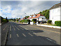
1
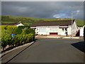
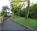
Glen Avenue
With Cauld Rocks visible on the horizon.
Image: © Thomas Nugent
Taken: 16 Jun 2018
0.13 miles
3
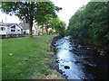
Riverside path at Glen Avenue
Houses on Glen Avenue, alongside Noddsdale Water.
Image: © Thomas Nugent
Taken: 16 Jun 2018
0.18 miles
4
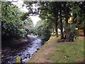
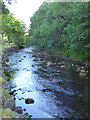
Noddsdale Water
Looking up the burn towards Glen Avenue.
Image: © Thomas Nugent
Taken: 23 Jul 2009
0.19 miles
5
Riverside path at Glen Avenue
Houses on Glen Avenue, alongside Noddsdale Water.
Image: © Thomas Nugent
Taken: 16 Jun 2018
0.20 miles
6
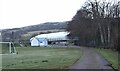
Inverclyde National Sports Training Centre
Image: © Alan Reid
Taken: 19 Mar 2022
0.21 miles
8
Noddsdale Water
Houses on Glen Avenue, alongside Noddsdale Water.
Image: © Thomas Nugent
Taken: 16 Jun 2018
0.21 miles
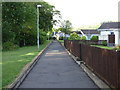
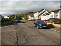
9
Burnside Way
At the top of Burnside Road.
Image: © Thomas Nugent
Taken: 16 Jun 2018
0.22 miles
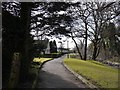
10
Glen Avenue
At the foot of Brisbane Glen on the north side of Largs.
Image: © Thomas Nugent
Taken: 16 Jun 2018
0.24 miles