IMAGES TAKEN NEAR TO
Castleview, KILMARNOCK, KA2 9JB
Introduction
This page details the photographs taken nearby to Castleview, KA2 9JB by members of the Geograph project.
The Geograph project started in 2005 with the aim of publishing, organising and preserving representative images for every square kilometre of Great Britain, Ireland and the Isle of Man.

There are currently over 7.5m images from over14,400 individuals and you can help contribute to the project by visiting https://www.geograph.org.uk
Image Map (Loading...)


Getting Data...Please wait
Leaflet Map data © OpenStreetMap
Images are licensed for reuse under creativecommons.org/licenses/by-sa/2.0
Notes
- Clicking on the map will re-center to the selected point.
- The higher the marker number, the further away the image location is from the centre of the postcode.
Image Listing (60 Images Found)
Images are licensed for reuse under creativecommons.org/licenses/by-sa/2.0
Image
Details
Distance
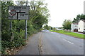
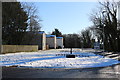
4
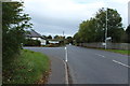
The A759 to Kilmarnock near Dundonald
Image: © Billy McCrorie
Taken: 12 Oct 2013
0.09 miles
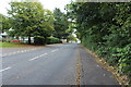
10
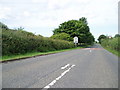
Speed limit sign
On the outskirts of Dundonald on the A759 road from Kilmarnock to Troon.
Image: © Gordon Dowie
Taken: 12 Jul 2010
0.10 miles