IMAGES TAKEN NEAR TO
Hadyard Terrace, GIRVAN, KA26 9SR
Introduction
This page details the photographs taken nearby to Hadyard Terrace, KA26 9SR by members of the Geograph project.
The Geograph project started in 2005 with the aim of publishing, organising and preserving representative images for every square kilometre of Great Britain, Ireland and the Isle of Man.

There are currently over 7.5m images from over14,400 individuals and you can help contribute to the project by visiting https://www.geograph.org.uk
Image Map
Images are licensed for reuse under creativecommons.org/licenses/by-sa/2.0
Notes
- Clicking on the map will re-center to the selected point.
- The higher the marker number, the further away the image location is from the centre of the postcode.
Image Listing (206 Images Found)
Images are licensed for reuse under creativecommons.org/licenses/by-sa/2.0
Image
Details
Distance
2
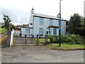
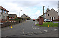
Old Surgery, Dailly
Extension on the left was the surgery for many years. Houses behind the old surgery are in Church Crescent.
Image: © Billy McCrorie
Taken: 26 Jul 2012
0.07 miles
7
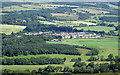
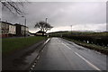
Dailly village view
A closer look at the village of Dailly, in the Central Lowlands, taken from the edge of Maxwellston Hill, in the Southern Uplands.
Image: © Mary and Angus Hogg
Taken: 21 Jul 2020
0.08 miles
9
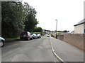
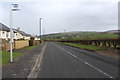
Back Road, Dailly
Leading to Woodside.
Image: © Billy McCrorie
Taken: 26 Jul 2012
0.08 miles