IMAGES TAKEN NEAR TO
Pinmore, GIRVAN, KA26 0TN
Introduction
This page details the photographs taken nearby to KA26 0TN by members of the Geograph project.
The Geograph project started in 2005 with the aim of publishing, organising and preserving representative images for every square kilometre of Great Britain, Ireland and the Isle of Man.

There are currently over 7.5m images from over14,400 individuals and you can help contribute to the project by visiting https://www.geograph.org.uk
Image Map
Images are licensed for reuse under creativecommons.org/licenses/by-sa/2.0
Notes
- Clicking on the map will re-center to the selected point.
- The higher the marker number, the further away the image location is from the centre of the postcode.
Image Listing (11 Images Found)
Images are licensed for reuse under creativecommons.org/licenses/by-sa/2.0
Image
Details
Distance
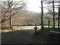
1
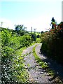
Track by Asselfoot Farm
The track from here leads down to Assel Bridge on the River Stinchar.
Image: © Andy Farrington
Taken: 30 Aug 2012
0.03 miles
2
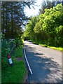
A714 by Asselfoot
The main Newton Stewart to Girvan road runs past the farm at this point.
Image: © Andy Farrington
Taken: 30 Aug 2012
0.04 miles
3
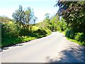
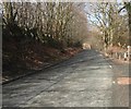
Road to Girvan
Looking at the A714 by Asselfoot.
Image: © Andy Farrington
Taken: 30 Aug 2012
0.08 miles
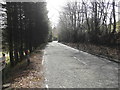
5
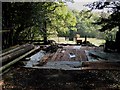
Building materials by the side of the A714
Near Asselfoot
Image: © Oliver Dixon
Taken: 14 Oct 2006
0.10 miles
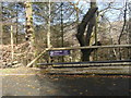
6
An area to be developed?
A notice by the side of this entrance says "Halliday West, Chartered Building Surveyors". Is the land to be developed?
Image: © Ann Cook
Taken: 29 Apr 2013
0.11 miles
7
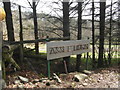
Assel Burn
Assel Burn seems to be the name of a clearing which is going to be developed.
Image: © Ann Cook
Taken: 29 Apr 2013
0.11 miles
8
A notice by the side of the A714
This notice is to the left of an entrance into a clearing which appears to be about to be developed. A sign on the right-hand side of the entrance says "Assel Burn".
Image: © Ann Cook
Taken: 29 Apr 2013
0.12 miles
10
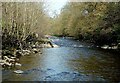
The River Stinchar
Looking upstream on a bright March afternoon.
Image: © Mary and Angus Hogg
Taken: 25 Mar 2012
0.20 miles