IMAGES TAKEN NEAR TO
Knockdolian Estate, GIRVAN, KA26 0LB
Introduction
This page details the photographs taken nearby to Knockdolian Estate, KA26 0LB by members of the Geograph project.
The Geograph project started in 2005 with the aim of publishing, organising and preserving representative images for every square kilometre of Great Britain, Ireland and the Isle of Man.

There are currently over 7.5m images from over14,400 individuals and you can help contribute to the project by visiting https://www.geograph.org.uk
Image Map
Images are licensed for reuse under creativecommons.org/licenses/by-sa/2.0
Notes
- Clicking on the map will re-center to the selected point.
- The higher the marker number, the further away the image location is from the centre of the postcode.
Image Listing (38 Images Found)
Images are licensed for reuse under creativecommons.org/licenses/by-sa/2.0
Image
Details
Distance
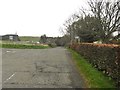
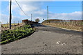
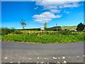
2
B734 in Knockdolian
View to this small village near Colmonell.
Image: © Andy Farrington
Taken: 30 Aug 2012
0.03 miles
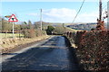
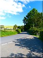
5
Looking north at the junction of the B7044 with the B734
Image: © Ann Cook
Taken: 28 Apr 2013
0.05 miles
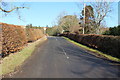
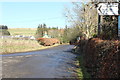
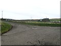
6
Junction in Knockdolian
View of the junction of the B734 ahead with the B7044 where the photographer is standing.
Image: © Andy Farrington
Taken: 30 Aug 2012
0.05 miles