IMAGES TAKEN NEAR TO
DALRY, KA24 4EQ
Introduction
This page details the photographs taken nearby to KA24 4EQ by members of the Geograph project.
The Geograph project started in 2005 with the aim of publishing, organising and preserving representative images for every square kilometre of Great Britain, Ireland and the Isle of Man.

There are currently over 7.5m images from over14,400 individuals and you can help contribute to the project by visiting https://www.geograph.org.uk
Image Map
Images are licensed for reuse under creativecommons.org/licenses/by-sa/2.0
Notes
- Clicking on the map will re-center to the selected point.
- The higher the marker number, the further away the image location is from the centre of the postcode.
Image Listing (9 Images Found)
Images are licensed for reuse under creativecommons.org/licenses/by-sa/2.0
Image
Details
Distance
1
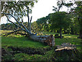
Felled Beech Tree
At the roadside therefore I think it was deemed dangerous!
Image: © wfmillar
Taken: 3 Oct 2008
0.15 miles
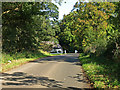
3
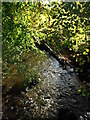
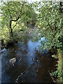
Dusk Bridge
Dusk Water flows under this road on route to join the River Garnock.
Image: © wfmillar
Taken: 3 Oct 2008
0.17 miles
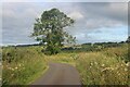
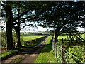
6
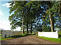
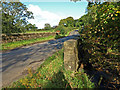
Newhouse Farm Road
Entrance from the minor road between Dalry and kilwinning.
Image: © wfmillar
Taken: 3 Oct 2008
0.20 miles