IMAGES TAKEN NEAR TO
SALTCOATS, KA21 6NQ
Introduction
This page details the photographs taken nearby to KA21 6NQ by members of the Geograph project.
The Geograph project started in 2005 with the aim of publishing, organising and preserving representative images for every square kilometre of Great Britain, Ireland and the Isle of Man.

There are currently over 7.5m images from over14,400 individuals and you can help contribute to the project by visiting https://www.geograph.org.uk
Image Map
Images are licensed for reuse under creativecommons.org/licenses/by-sa/2.0
Notes
- Clicking on the map will re-center to the selected point.
- The higher the marker number, the further away the image location is from the centre of the postcode.
Image Listing (10 Images Found)
Images are licensed for reuse under creativecommons.org/licenses/by-sa/2.0
Image
Details
Distance
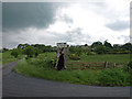
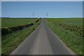
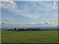
2
Bankhead Farm
Viewed from The Auld Clay Road.
Image: © wfmillar
Taken: 3 Oct 2008
0.07 miles
5
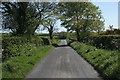
Looking down the hill
A T-junction is at the bottom.
Image: © Richard Sutcliffe
Taken: 14 May 2016
0.21 miles
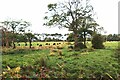
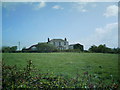
8
Lochwood Farm
Viewed from The Auld Clay Road looking due south.
Image: © wfmillar
Taken: 3 Oct 2008
0.22 miles
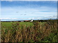
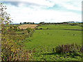
9
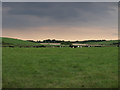
The cows are lying down, near Ashgrove/ Stevenston Loch
Very sultry weather.
Image: © wfmillar
Taken: 30 May 2008
0.23 miles