IMAGES TAKEN NEAR TO
STEVENSTON, KA20 4JX
Introduction
This page details the photographs taken nearby to KA20 4JX by members of the Geograph project.
The Geograph project started in 2005 with the aim of publishing, organising and preserving representative images for every square kilometre of Great Britain, Ireland and the Isle of Man.

There are currently over 7.5m images from over14,400 individuals and you can help contribute to the project by visiting https://www.geograph.org.uk
Image Map
Images are licensed for reuse under creativecommons.org/licenses/by-sa/2.0
Notes
- Clicking on the map will re-center to the selected point.
- The higher the marker number, the further away the image location is from the centre of the postcode.
Image Listing (19 Images Found)
Images are licensed for reuse under creativecommons.org/licenses/by-sa/2.0
Image
Details
Distance
1
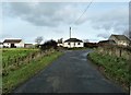
Greenhead Smallholdings - Stevenston
Greenhead Smallholdings
Image: © Raibeart MacAoidh
Taken: 2 Nov 2018
0.01 miles
2
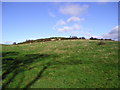
Fellie Hill
Field with tree shadows on the lower slopes of Fellie Hill, photograph taken from the road just west of Greenhead Smallholdings.
Image: © Chris Court
Taken: 13 Oct 2005
0.04 miles
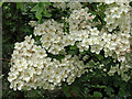
4
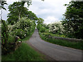
Hawthorn, Stevenston
Fantastic display at this time of year (May).
Image: © wfmillar
Taken: 30 May 2008
0.16 miles
6
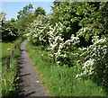
Hawthorn, Stevenston
This path runs beside the Stevenston Burn. Hawthorn is in full bloom.
Image: © wfmillar
Taken: 29 May 2008
0.18 miles
7
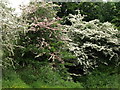
Hawthorn, Stevenston
Common? Well yes, all over the country. But one of the most spectacular blooms of the year.
Image: © wfmillar
Taken: 30 May 2008
0.18 miles
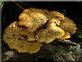
8
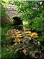
Dead wood, Stevenston Burn
Bracket Fungus adorns the dead tree.
Image: © wfmillar
Taken: 29 May 2008
0.18 miles
9
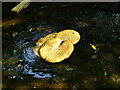
Bracket Fungus, Stevenston Burn
Someone had dislodged this piece of fungi and it was resting in the burn. It must be quite heavy.
Image: © wfmillar
Taken: 29 May 2008
0.18 miles
10
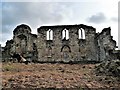
Kerelaw Castle - Stevenston
Originally a property of the Loccard (Lockhart) family, this 15th-century castle of the Cunningham Earls of Glencairn was destroyed as the result of a feud with the Montgomerie's of Eglinton. Nearby Eglinton Castle was later burned in retaliation. The Gothic windows were added around 1830 when the ruin became a garden folly for the 18th-century mansion of Kerelaw House which stood nearby until demolished around 1970.
Image: © Raibeart MacAoidh
Taken: 2 Nov 2018
0.20 miles