IMAGES TAKEN NEAR TO
STEVENSTON, KA20 3DB
Introduction
This page details the photographs taken nearby to KA20 3DB by members of the Geograph project.
The Geograph project started in 2005 with the aim of publishing, organising and preserving representative images for every square kilometre of Great Britain, Ireland and the Isle of Man.

There are currently over 7.5m images from over14,400 individuals and you can help contribute to the project by visiting https://www.geograph.org.uk
Image Map (Loading...)


Getting Data...Please wait
Leaflet Map data © OpenStreetMap
Images are licensed for reuse under creativecommons.org/licenses/by-sa/2.0
Notes
- Clicking on the map will re-center to the selected point.
- The higher the marker number, the further away the image location is from the centre of the postcode.
Image Listing (10 Images Found)
Images are licensed for reuse under creativecommons.org/licenses/by-sa/2.0
Image
Details
Distance
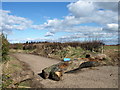
2
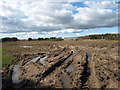
Field Tractor Tracks, Ardreer
Field is badly churned up due to the very wet conditions.
Image: © wfmillar
Taken: 16 Mar 2008
0.08 miles
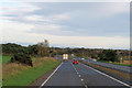
3
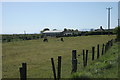
Todhill Country Centre
A couple of ponies graze in the field beside the centre, which is a residential centre for adults with learning difficulties. Viewed from a lay-by on the A78.
Image: © Richard Sutcliffe
Taken: 14 May 2016
0.08 miles
4
Old Track Near Kilwinning
This old track doesn't seem to be used much, judging by the growth of vegetation just round the corner.
Image: © Mary and Angus Hogg
Taken: 20 Mar 2018
0.09 miles
5
Road Block, Ardeer
Tree trunk denies vehicular access.
Image: © wfmillar
Taken: 16 Mar 2008
0.09 miles
7
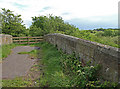
Old Bridge
Once crossed a railway line which is now used as a quarry road.Image
Image: © wfmillar
Taken: 14 May 2009
0.17 miles
9
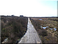
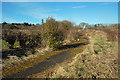
Quarry Road
This road leads to an active sand and gravel quarry located on the outskirts of Ardeer (located at NS389417). This section of the road was once the route of the Caledonian Railway from Stevenston Moorpark to Kilwinning East. Photo was taken from a bridge that once crossed the railway. To the right (north) of the road is the Todhill Community Woodland, planted on top of a former landfill site.
Image: © SGM
Taken: 13 Apr 2006
0.20 miles
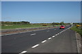
10
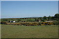
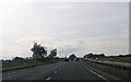
Fields beside the A78
Looking south-east from a lay-by on the A78.
Image: © Richard Sutcliffe
Taken: 14 May 2016
0.20 miles