IMAGES TAKEN NEAR TO
Kirkoswald, MAYBOLE, KA19 8HU
Introduction
This page details the photographs taken nearby to KA19 8HU by members of the Geograph project.
The Geograph project started in 2005 with the aim of publishing, organising and preserving representative images for every square kilometre of Great Britain, Ireland and the Isle of Man.

There are currently over 7.5m images from over14,400 individuals and you can help contribute to the project by visiting https://www.geograph.org.uk
Image Map
Images are licensed for reuse under creativecommons.org/licenses/by-sa/2.0
Notes
- Clicking on the map will re-center to the selected point.
- The higher the marker number, the further away the image location is from the centre of the postcode.
Image Listing (17 Images Found)
Images are licensed for reuse under creativecommons.org/licenses/by-sa/2.0
Image
Details
Distance
1

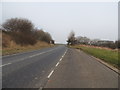
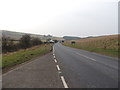
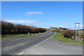
Old Milestone by the A77, near Minneybae, Kirkoswald parish
Stone post by the A77, in parish of Kirkoswald (Carrick District), Minneybae, 15m from junction sign.
Inscription reads:-
: MAYBOLE / 5 : : GIRVAN / 7 :
Surveyed
Milestone Society National ID: AYS_GVMBA07
Image: © Milestone Society
Taken: Unknown
0.01 miles

6
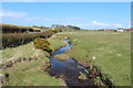
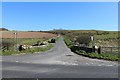
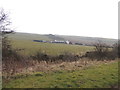
Milton Burn
Farm on the right is Minnybae.
Image: © Billy McCrorie
Taken: 1 May 2013
0.10 miles