IMAGES TAKEN NEAR TO
MAYBOLE, KA19 8DZ
Introduction
This page details the photographs taken nearby to KA19 8DZ by members of the Geograph project.
The Geograph project started in 2005 with the aim of publishing, organising and preserving representative images for every square kilometre of Great Britain, Ireland and the Isle of Man.

There are currently over 7.5m images from over14,400 individuals and you can help contribute to the project by visiting https://www.geograph.org.uk
Image Map
Images are licensed for reuse under creativecommons.org/licenses/by-sa/2.0
Notes
- Clicking on the map will re-center to the selected point.
- The higher the marker number, the further away the image location is from the centre of the postcode.
Image Listing (26 Images Found)
Images are licensed for reuse under creativecommons.org/licenses/by-sa/2.0
Image
Details
Distance
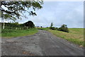
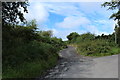
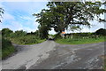
8
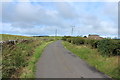
Road to Glenalmond
This road also part of the Maybole to Dunure Path which is a seven mile walk.
Image: © Billy McCrorie
Taken: 24 Aug 2013
0.16 miles
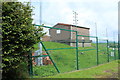
9
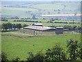
Water board building, Preaching Brae
Fortified building above Maybole.
Image: © Richard Webb
Taken: 13 Aug 2014
0.17 miles