IMAGES TAKEN NEAR TO
Straiton, MAYBOLE, KA19 7NN
Introduction
This page details the photographs taken nearby to KA19 7NN by members of the Geograph project.
The Geograph project started in 2005 with the aim of publishing, organising and preserving representative images for every square kilometre of Great Britain, Ireland and the Isle of Man.

There are currently over 7.5m images from over14,400 individuals and you can help contribute to the project by visiting https://www.geograph.org.uk
Image Map
Images are licensed for reuse under creativecommons.org/licenses/by-sa/2.0
Notes
- Clicking on the map will re-center to the selected point.
- The higher the marker number, the further away the image location is from the centre of the postcode.
Image Listing (19 Images Found)
Images are licensed for reuse under creativecommons.org/licenses/by-sa/2.0
Image
Details
Distance
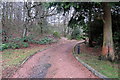
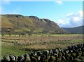
2
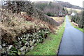
Towards Balbeg
Looking along the farm road towards the cottages at Balbeg, in the Girvan Valley.
Image: © Mary and Angus Hogg
Taken: 6 Feb 2008
0.11 miles
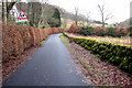
5
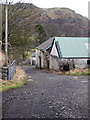
Towards Craigencallie
Looking across the Girvan Valley floodplain from the Dalmorton farm road. Craigencallie is in the next square.
Image: © Mary and Angus Hogg
Taken: 6 Feb 2008
0.14 miles
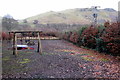
6
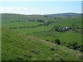
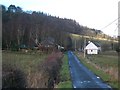
View To Dalmorton
Dalmorton viewed from high up on the other side of the Girvan Valley.
Image: © Mary and Angus Hogg
Taken: 14 May 2008
0.14 miles