IMAGES TAKEN NEAR TO
New Cumnock, CUMNOCK, KA18 4PW
Introduction
This page details the photographs taken nearby to KA18 4PW by members of the Geograph project.
The Geograph project started in 2005 with the aim of publishing, organising and preserving representative images for every square kilometre of Great Britain, Ireland and the Isle of Man.

There are currently over 7.5m images from over14,400 individuals and you can help contribute to the project by visiting https://www.geograph.org.uk
Image Map
Images are licensed for reuse under creativecommons.org/licenses/by-sa/2.0
Notes
- Clicking on the map will re-center to the selected point.
- The higher the marker number, the further away the image location is from the centre of the postcode.
Image Listing (23 Images Found)
Images are licensed for reuse under creativecommons.org/licenses/by-sa/2.0
Image
Details
Distance
2
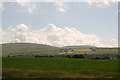
New Cumnock
This photo shows the town of New Cumnock and, on the horizon, a wind farm.
Image: © L J Cunningham
Taken: 27 Jul 2006
0.09 miles
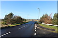
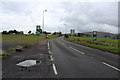
7
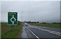
A76 approaching roundabout near Pathhead
Towards Dumfries.
Image: © JThomas
Taken: 21 May 2021
0.13 miles
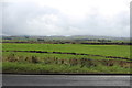
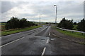
8
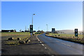
Approaching New Cumnock, New Year's Day
Image: © Billy McCrorie
Taken: 1 Jan 2019
0.14 miles