IMAGES TAKEN NEAR TO
CUMNOCK, KA18 2SG
Introduction
This page details the photographs taken nearby to KA18 2SG by members of the Geograph project.
The Geograph project started in 2005 with the aim of publishing, organising and preserving representative images for every square kilometre of Great Britain, Ireland and the Isle of Man.

There are currently over 7.5m images from over14,400 individuals and you can help contribute to the project by visiting https://www.geograph.org.uk
Image Map
Images are licensed for reuse under creativecommons.org/licenses/by-sa/2.0
Notes
- Clicking on the map will re-center to the selected point.
- The higher the marker number, the further away the image location is from the centre of the postcode.
Image Listing (5 Images Found)
Images are licensed for reuse under creativecommons.org/licenses/by-sa/2.0
Image
Details
Distance
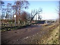
1
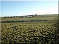
Rough grazing
Greenfield farm in the distance.
Image: © Gordon Brown
Taken: 6 Feb 2007
0.03 miles
2
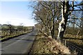
Road and strip wood
The road passes Greenfield on the way to Skares.
Image: © Richard Webb
Taken: 21 Jan 2017
0.14 miles
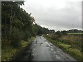
4
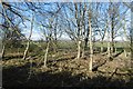
A strip wood
The road running through Skares is often accompanied by a shelter belt.
Image: © Richard Webb
Taken: 21 Jan 2017
0.17 miles