IMAGES TAKEN NEAR TO
Mauchline Road, KILMARNOCK, KA1 5JL
Introduction
This page details the photographs taken nearby to Mauchline Road, KA1 5JL by members of the Geograph project.
The Geograph project started in 2005 with the aim of publishing, organising and preserving representative images for every square kilometre of Great Britain, Ireland and the Isle of Man.

There are currently over 7.5m images from over14,400 individuals and you can help contribute to the project by visiting https://www.geograph.org.uk
Image Map
Images are licensed for reuse under creativecommons.org/licenses/by-sa/2.0
Notes
- Clicking on the map will re-center to the selected point.
- The higher the marker number, the further away the image location is from the centre of the postcode.
Image Listing (10 Images Found)
Images are licensed for reuse under creativecommons.org/licenses/by-sa/2.0
Image
Details
Distance
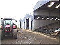
2
Loading up
Lorries in the loading bay at Diageo in East Ayrshire
Image: © Angela Mudge
Taken: 19 Jul 2006
0.09 miles
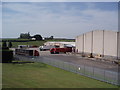
4
Site of Barleith Station
View westward, towards Kilmarnock; ex-GSWR Kilmarnock - Darvel line, closed when passenger service withdrawn 6/4/64; complete closure of the line was on 6/7/64. A new factory has been built on the site since.
Image: © Ben Brooksbank
Taken: 26 Sep 1974
0.19 miles
5
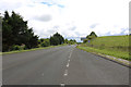
The A76 to Cumnock
At Barleith near Kilmarnock.
Image: © Billy McCrorie
Taken: 7 Jul 2020
0.19 miles
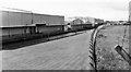
6
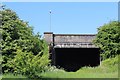
Road bridge over dismantled railway, Hurlford
Image: © Leslie Barrie
Taken: 31 May 2014
0.19 miles
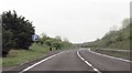
8
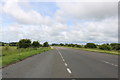
The A76 to Kilmarnock
About two miles to go to Kilmarnock.
Image: © Billy McCrorie
Taken: 7 Jul 2020
0.23 miles
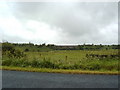
9
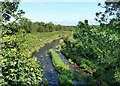
Cessnock Water view
Viewed looking downstream near Little Barleith. Riverside access during the summer is tricky due to the growth of vegetation along the banks.
Image: © Mary and Angus Hogg
Taken: 13 Aug 2020
0.23 miles
10
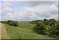
Farmland at Hurlford
Viewed from the A76.
Image: © Billy McCrorie
Taken: 7 Jul 2020
0.25 miles