IMAGES TAKEN NEAR TO
Riccarton Road, KILMARNOCK, KA1 5AE
Introduction
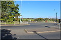
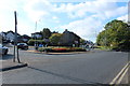
This page details the photographs taken nearby to Riccarton Road, KA1 5AE by members of the Geograph project.
The Geograph project started in 2005 with the aim of publishing, organising and preserving representative images for every square kilometre of Great Britain, Ireland and the Isle of Man.

There are currently over 7.5m images from over14,400 individuals and you can help contribute to the project by visiting https://www.geograph.org.uk
Image Map
Images are licensed for reuse under creativecommons.org/licenses/by-sa/2.0
Notes
- Clicking on the map will re-center to the selected point.
- The higher the marker number, the further away the image location is from the centre of the postcode.
Image Listing (50 Images Found)
Images are licensed for reuse under creativecommons.org/licenses/by-sa/2.0
Image
Details
Distance
2
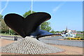
Last Propeller cast by Strang's Foundry, Hurlford
Placed on site by Hurlford & Crookedholm Community Council September 1984 to commemorate aspects of working life of communities between mid 19th-20th centuries.
Image: © Leslie Barrie
Taken: 31 May 2014
0.03 miles