IMAGES TAKEN NEAR TO
Mains Road, BEITH, KA15 2HR
Introduction
This page details the photographs taken nearby to Mains Road, KA15 2HR by members of the Geograph project.
The Geograph project started in 2005 with the aim of publishing, organising and preserving representative images for every square kilometre of Great Britain, Ireland and the Isle of Man.

There are currently over 7.5m images from over14,400 individuals and you can help contribute to the project by visiting https://www.geograph.org.uk
Image Map
Images are licensed for reuse under creativecommons.org/licenses/by-sa/2.0
Notes
- Clicking on the map will re-center to the selected point.
- The higher the marker number, the further away the image location is from the centre of the postcode.
Image Listing (10 Images Found)
Images are licensed for reuse under creativecommons.org/licenses/by-sa/2.0
Image
Details
Distance
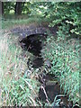
1
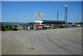
Industrial estate, Beith
At the end of Mains Road.
Image: © Richard Sutcliffe
Taken: 29 Jun 2018
0.09 miles
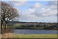
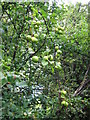
5
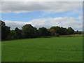
First sign of Autumn. Mains, Beith
Green field but a tint of orange in the trees.
Image: © wfmillar
Taken: 2 Sep 2007
0.16 miles
7
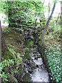
Small Burn, Mains, Beith
This unnamed burn joins Mains Burn about 20 metres further on.
Image: © wfmillar
Taken: 2 Sep 2007
0.18 miles
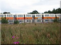
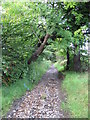
10
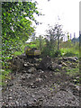
Small Earth Mover
Track at Whisky Bonded Warehouses Beith.
Image: © wfmillar
Taken: 2 Sep 2007
0.19 miles