IMAGES TAKEN NEAR TO
Thorntree Avenue, BEITH, KA15 2EE
Introduction
This page details the photographs taken nearby to Thorntree Avenue, KA15 2EE by members of the Geograph project.
The Geograph project started in 2005 with the aim of publishing, organising and preserving representative images for every square kilometre of Great Britain, Ireland and the Isle of Man.

There are currently over 7.5m images from over14,400 individuals and you can help contribute to the project by visiting https://www.geograph.org.uk
Image Map
Images are licensed for reuse under creativecommons.org/licenses/by-sa/2.0
Notes
- Clicking on the map will re-center to the selected point.
- The higher the marker number, the further away the image location is from the centre of the postcode.
Image Listing (70 Images Found)
Images are licensed for reuse under creativecommons.org/licenses/by-sa/2.0
Image
Details
Distance
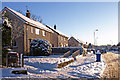
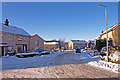
1
Thorntree Avenue, Beith
Looking down to the Kilbirnie Hills.
Image: © wfmillar
Taken: 8 Dec 2010
0.04 miles
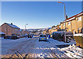
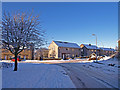
2
Cypress Avenue, Beith
Looking towards Throntree Avenue.
Image: © wfmillar
Taken: 8 Dec 2010
0.05 miles
3
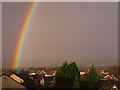
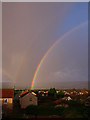
Rainbow and Roofs
Looking over the roofs to the Garnock Valley.
Image: © wfmillar
Taken: 27 Nov 2009
0.05 miles
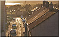
4
Rainbows and Roofs
Beith,North Ayrshire during a very heavy shower. Looking towards the Garnock Valley.
Image: © wfmillar
Taken: 27 Nov 2009
0.07 miles
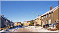
5
Beech Avenue, Beith
The corner before the road joins with Cypress Avenue on the right.
Image: © wfmillar
Taken: 8 Dec 2010
0.07 miles
6
Beech Avenue, Beith
Beech Avenue continues round to the left with Cypress Avenue on the right. Many of the street names in Beith are named after trees.
Image: © wfmillar
Taken: 8 Dec 2010
0.07 miles
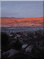
7
Cherrywood Drive/Thorntree Avenue, Beith
View from Roebank Road at near sunset. Kilbirnie Loch in the valley. The light nights encourage the kids to play in the streets.
Image: © wfmillar
Taken: 7 Apr 2010
0.09 miles
8
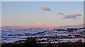
Moon at Sunrise
View over Beith to the Kilbirnie Hills. The highest hill is Black law and the deep valley is cut by the Garnock River. Viewed from Roebank Road Beith.
Image: © wfmillar
Taken: 2 Jan 2010
0.09 miles
9
Frosty Morning Sunrise
View over Beith to the Kilbirnie Hills. The highest hill is Black law and the deep valley is cut by the Garnock River. Viewed from Roebank Road Beith.
Image: © wfmillar
Taken: 26 Dec 2005
0.10 miles