IMAGES TAKEN NEAR TO
Auldlea Road, BEITH, KA15 2BZ
Introduction
This page details the photographs taken nearby to Auldlea Road, KA15 2BZ by members of the Geograph project.
The Geograph project started in 2005 with the aim of publishing, organising and preserving representative images for every square kilometre of Great Britain, Ireland and the Isle of Man.

There are currently over 7.5m images from over14,400 individuals and you can help contribute to the project by visiting https://www.geograph.org.uk
Image Map
Images are licensed for reuse under creativecommons.org/licenses/by-sa/2.0
Notes
- Clicking on the map will re-center to the selected point.
- The higher the marker number, the further away the image location is from the centre of the postcode.
Image Listing (98 Images Found)
Images are licensed for reuse under creativecommons.org/licenses/by-sa/2.0
Image
Details
Distance
1
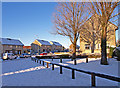
Beech Avenue, Beith
A wee, normally green patch at the end of the avenue.
Image: © wfmillar
Taken: 8 Dec 2010
0.07 miles
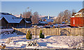
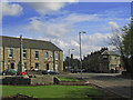
2
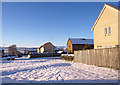
Gap in Beech Avenue, Beith
Looking down Maple Drive with Kilbirnie Hills in the distance.
Image: © wfmillar
Taken: 8 Dec 2010
0.09 miles
4
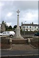
War memorial.
The war memorial at the foot of Kings Road in Beith. This memorial used to be near the top of the Bigholm hill but was moved some time ago.
Image: © Alex Mcnaughton
Taken: 17 Sep 2006
0.11 miles
5
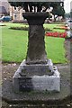
A gift to the people of Beith
A small ornament which was a gift to the people of Beith from Lady Cochran-Patrick. She was a land owner in the past. This is situated at the foot of Kings Road near the war memorial.
Image: © Alex Mcnaughton
Taken: 17 Sep 2006
0.11 miles
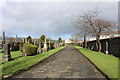
6
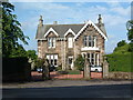
Laigh Road,Beith
Shelter Housing on the left. The spire in the centre of frame belongs to the Church of Jesus Christ of Latter Day Saints Auldlea Road.
Image: © wfmillar
Taken: 8 Dec 2010
0.11 miles
8
Kings Road and Janefield Place, Beith
Misty Law in the distance.
Image: © wfmillar
Taken: 9 May 2007
0.12 miles
9
Park View and Kings Road, Beith
War memorial to the left.
Image: © wfmillar
Taken: 9 May 2007
0.12 miles
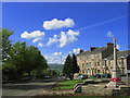
10
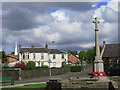
Beith war Memorial
Looking towards Woodside Road with the Mormon church spire to the left. The war memorial was moved here from the Bigholm hill to the east of Beith as the high winds kept toppling it.
Image: © wfmillar
Taken: 9 May 2007
0.12 miles