IMAGES TAKEN NEAR TO
Barrmill Road, BEITH, KA15 1JU
Introduction
This page details the photographs taken nearby to Barrmill Road, KA15 1JU by members of the Geograph project.
The Geograph project started in 2005 with the aim of publishing, organising and preserving representative images for every square kilometre of Great Britain, Ireland and the Isle of Man.

There are currently over 7.5m images from over14,400 individuals and you can help contribute to the project by visiting https://www.geograph.org.uk
Image Map
Images are licensed for reuse under creativecommons.org/licenses/by-sa/2.0
Notes
- Clicking on the map will re-center to the selected point.
- The higher the marker number, the further away the image location is from the centre of the postcode.
Image Listing (10 Images Found)
Images are licensed for reuse under creativecommons.org/licenses/by-sa/2.0
Image
Details
Distance
1
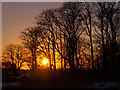
Trees at Sunset, Beith
The trees, mainly Beech are in the grounds of the demolished Speirs school.http://en.wikipedia.org/wiki/Spier%27s_school
Image: © wfmillar
Taken: 5 Dec 2010
0.04 miles
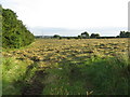
2
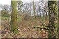
Spier's School grounds, Beith
The school closed in 1972 and the buildings were subsequently demolished. The grounds are now a park.
Image: © Richard Webb
Taken: 15 Nov 2014
0.05 miles
3
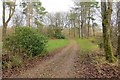
Spier's School grounds, Beith
The school closed in 1972 and the buildings were subsequently demolished. The grounds are now a park.
Image: © Richard Webb
Taken: 15 Nov 2014
0.06 miles
4
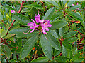
Rhododendron, Beith
In the grounds of demolished Spiers School. Surprised to find this in bloom in October.
Image: © wfmillar
Taken: 13 Oct 2011
0.07 miles
6
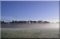
As the Mist Clears
The sun putting in an appearance to burn off the early mist bringing the woodland into view.
Image: © Chris Court
Taken: 25 Dec 2005
0.18 miles
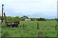
7
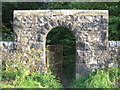
Geilsland Gate to Spiers School, Beith
The school is now demolished.
Image: © wfmillar
Taken: 20 Jul 2007
0.20 miles
10
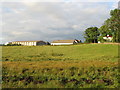
Geilsland School, Beith
OS Explorer Map 341 shows Geisland, the correct spelling is Geilsland.
Image: © wfmillar
Taken: 20 Jul 2007
0.25 miles