IMAGES TAKEN NEAR TO
KILWINNING, KA13 7RU
Introduction
This page details the photographs taken nearby to KA13 7RU by members of the Geograph project.
The Geograph project started in 2005 with the aim of publishing, organising and preserving representative images for every square kilometre of Great Britain, Ireland and the Isle of Man.

There are currently over 7.5m images from over14,400 individuals and you can help contribute to the project by visiting https://www.geograph.org.uk
Image Map
Images are licensed for reuse under creativecommons.org/licenses/by-sa/2.0
Notes
- Clicking on the map will re-center to the selected point.
- The higher the marker number, the further away the image location is from the centre of the postcode.
Image Listing (4 Images Found)
Images are licensed for reuse under creativecommons.org/licenses/by-sa/2.0
Image
Details
Distance
1
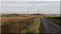
Road, Lissens Moss
Amongst bog lands north of Kilwinning.
Image: © Richard Webb
Taken: 15 Nov 2014
0.15 miles
2
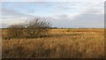
Lissens Moss
One of several surviving bogs near Kilwinning.
Image: © Richard Webb
Taken: 15 Nov 2014
0.20 miles
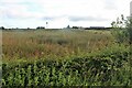
4
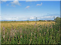
Lissens Moss Farm
Looking over the fallow fields towards the farm.
Image: © wfmillar
Taken: 9 Sep 2009
0.23 miles