IMAGES TAKEN NEAR TO
Watercut Road, KILWINNING, KA13 7PX
Introduction
This page details the photographs taken nearby to Watercut Road, KA13 7PX by members of the Geograph project.
The Geograph project started in 2005 with the aim of publishing, organising and preserving representative images for every square kilometre of Great Britain, Ireland and the Isle of Man.

There are currently over 7.5m images from over14,400 individuals and you can help contribute to the project by visiting https://www.geograph.org.uk
Image Map
Images are licensed for reuse under creativecommons.org/licenses/by-sa/2.0
Notes
- Clicking on the map will re-center to the selected point.
- The higher the marker number, the further away the image location is from the centre of the postcode.
Image Listing (40 Images Found)
Images are licensed for reuse under creativecommons.org/licenses/by-sa/2.0
Image
Details
Distance
1
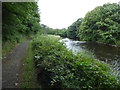
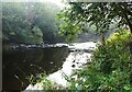
Weir on the River Garnock
This is at the tidal limit of the river, immediately east of the A78 dual carriageway, looking upstream.
Image: © Thomas Nugent
Taken: 6 Aug 2018
0.05 miles
2
Weir on the River Garnock
This is at the tidal limit of the river, immediately east of the A78 dual carriageway, looking upstream.
Image: © Thomas Nugent
Taken: 6 Aug 2018
0.05 miles
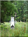
3
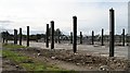
Ruined distribution centre
Aerial photos suggest that this was a big shed distribution centre. Now partially demolished with steel pillars surrounding a concrete floor.
Image: © Richard Webb
Taken: 13 Aug 2009
0.09 miles
4
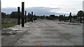
Partially demolished shed
The floor and steel pillars are all that remains of this big shed warehouse.
Image: © Richard Webb
Taken: 13 Aug 2009
0.09 miles
5
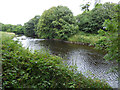
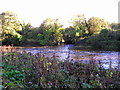
River Garnock, near to its tidal limit
The river rises on Hill of Stake, the highest point of the West Renfrew Heights to the north.
Image: © Alan Reid
Taken: 8 Sep 2023
0.10 miles
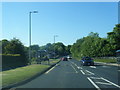
7
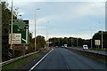
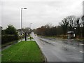
Southbound A78 approaching Eglinton Interchange
Image: © David Dixon
Taken: 23 Sep 2019
0.11 miles
8
Lugton Water
Lugton Water joining the river Garnock, both swollen by the last few days heavy rain.
Image: © Chris Court
Taken: 13 Oct 2005
0.11 miles
10
Pipeline crossing the River Garnock
Just west of the A78 dual carriageway.
Image: © Thomas Nugent
Taken: 6 Aug 2018
0.11 miles