IMAGES TAKEN NEAR TO
Wellwood, KILWINNING, KA13 6NG
Introduction
This page details the photographs taken nearby to Wellwood, KA13 6NG by members of the Geograph project.
The Geograph project started in 2005 with the aim of publishing, organising and preserving representative images for every square kilometre of Great Britain, Ireland and the Isle of Man.

There are currently over 7.5m images from over14,400 individuals and you can help contribute to the project by visiting https://www.geograph.org.uk
Image Map (Loading...)


Getting Data...Please wait
Leaflet Map data © OpenStreetMap
Images are licensed for reuse under creativecommons.org/licenses/by-sa/2.0
Notes
- Clicking on the map will re-center to the selected point.
- The higher the marker number, the further away the image location is from the centre of the postcode.
Image Listing (6 Images Found)
Images are licensed for reuse under creativecommons.org/licenses/by-sa/2.0
Image
Details
Distance
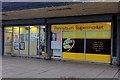
2
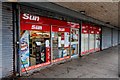
Pennyburn Newsagents & Post Office - Kilwinning
Image: © Ian Rainey
Taken: 31 May 2018
0.11 miles
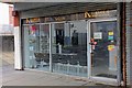
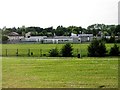
4
Pryde - Kilwinning
Pennyburn Regeneration Youth Development Enterprise
Image: © Ian Rainey
Taken: 31 May 2018
0.12 miles
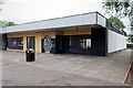
6
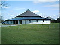
Mansfield Church
This modern circular Church replaced the old Mansfield Church nearer the town centre which was sold and is now a creche
Image: © Ian Rainey
Taken: 19 Apr 2006
0.23 miles