IMAGES TAKEN NEAR TO
College Wynd, KILMARNOCK, KA1 1HN

Introduction

This page details the photographs taken nearby to College Wynd, KA1 1HN by members of the Geograph project.

The Geograph project started in 2005 with the aim of publishing, organising and preserving representative images for every square kilometre of Great Britain, Ireland and the Isle of Man.

There are currently over 7.5m images from over14,400 individuals and you can help contribute to the project by visiting https://www.geograph.org.uk

Image Map


Images are licensed for reuse under creativecommons.org/licenses/by-sa/2.0
Notes
  • Clicking on the map will re-center to the selected point.
  • The higher the marker number, the further away the image location is from the centre of the postcode.

Image Listing (364 Images Found)

Images are licensed for reuse under creativecommons.org/licenses/by-sa/2.0
  • ...
Image
Details
Distance
1
College Wynd, Kilmarnock
Image: © Leslie Barrie Taken: 31 May 2014
0.01 miles
2
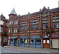
College Wynd, Kilmarnock
Pictured is a music shop / cafe and closed / empty property. Formerly the music shop was a Grocers providing a traditional family touch to shopping in contrast to the ever growing impersonal supermarkets. As evidenced by the key sign on the wall, the empty property was once a famous Ironmongers and Locksmiths. Both business were originally located on Portland Street before the redevelopment of the Town Centre in 1970's and 1980's.
Image: © Tom Morrison Taken: 23 Aug 2011
0.02 miles
3
Bank Street, Kilmarnock
View towards the Laigh Kirk.
Image: © Richard Webb Taken: 25 Sep 2015
0.02 miles
4
The Laigh Kirk, Kilmarnock
Category A-listed. The demolition of the previous church left only the 17th century tower remaining. The present church was built in 1802. Architect Robert Johnstone. It was later enlarged in 1831, then renovated 1903-4.
Image: © Leslie Barrie Taken: 31 May 2014
0.03 miles
5
Bank Place
Off John Finnie Street.
Image: © Thomas Nugent Taken: 27 Oct 2010
0.03 miles
6
Post Office on John Finnie Street
Detail of the corner of the building, includes a 1907 datestone. See the building here Image
Image: © Thomas Nugent Taken: 27 Oct 2010
0.03 miles
7
Riverbank, Kilmarnock
It looks as if it was once another kind of bank.
Image: © Richard Webb Taken: 25 Sep 2015
0.03 miles
8
New Laigh Kirk - Kilmarnock
The Laigh Kirk stands near the site where Mernoc is said by some to have established his church in the 7th century. In mediaeval times the Laigh Kirk was daughter church of Kilwinning Abbey, but has held allegiance to the Protestant faith since the reformation. The Kirkyard contains the graves of Covenanters and Tam Samson, one of Burns' cronies. The base of the tower dates from 1410. The upper part probably dates from the late 16th century. The present church dates from 1802. On 5th October 2000, the Laigh Kirk joined the West High Kirk to become Laigh West High Kirk.
Image: © Raibeart MacAoidh Taken: 18 May 2019
0.03 miles
9
The Clansman, Kilmarnock
On John Finnie Street.
Image: © JThomas Taken: 22 May 2021
0.03 miles
10
Corner of Low Church Lane & John Dickie Street, Kilmarnock
Image: © Leslie Barrie Taken: 31 May 2014
0.03 miles
  • ...