IMAGES TAKEN NEAR TO
Corsehill Mount Road, IRVINE, KA11 4JZ
Introduction
This page details the photographs taken nearby to Corsehill Mount Road, KA11 4JZ by members of the Geograph project.
The Geograph project started in 2005 with the aim of publishing, organising and preserving representative images for every square kilometre of Great Britain, Ireland and the Isle of Man.

There are currently over 7.5m images from over14,400 individuals and you can help contribute to the project by visiting https://www.geograph.org.uk
Image Map
Images are licensed for reuse under creativecommons.org/licenses/by-sa/2.0
Notes
- Clicking on the map will re-center to the selected point.
- The higher the marker number, the further away the image location is from the centre of the postcode.
Image Listing (61 Images Found)
Images are licensed for reuse under creativecommons.org/licenses/by-sa/2.0
Image
Details
Distance
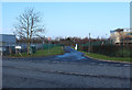
3
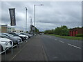
Corsehill Mount Road (B7081)
Towards Dreghorn.
Image: © JThomas
Taken: 23 May 2021
0.02 miles
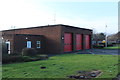
6
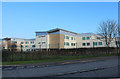
Delivery Entrance to Greenwood Academy, Dreghorn
Image: © Billy McCrorie
Taken: 14 Feb 2017
0.04 miles
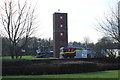
7
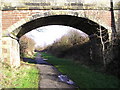
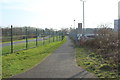
Old Rail Bridge
Bridge over the course of the old LM&S railway which is now part of the Irvine New Town Trail, and National Cycle route No. 73
Image: © Chris Court
Taken: 18 Feb 2006
0.05 miles