IMAGES TAKEN NEAR TO
Dalmore Way, IRVINE, KA11 2BT
Introduction
This page details the photographs taken nearby to Dalmore Way, KA11 2BT by members of the Geograph project.
The Geograph project started in 2005 with the aim of publishing, organising and preserving representative images for every square kilometre of Great Britain, Ireland and the Isle of Man.

There are currently over 7.5m images from over14,400 individuals and you can help contribute to the project by visiting https://www.geograph.org.uk
Image Map
Images are licensed for reuse under creativecommons.org/licenses/by-sa/2.0
Notes
- Clicking on the map will re-center to the selected point.
- The higher the marker number, the further away the image location is from the centre of the postcode.
Image Listing (7 Images Found)
Images are licensed for reuse under creativecommons.org/licenses/by-sa/2.0
Image
Details
Distance
3
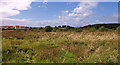
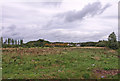
Scrubland, Girdle Toll
Looking towards housing at Redburn. This land will probably be built on.
Image: © wfmillar
Taken: 14 Sep 2010
0.12 miles
4
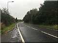
Rough ground, Eglinton Country Park
Beside the B7080 on the edge of Irvine.
Image: © Richard Webb
Taken: 1 Sep 2015
0.20 miles
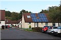
5
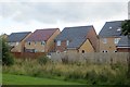
New houses, Irvine
Backing on to Long Drive and as yet not featuring on many maps.
Image: © Richard Webb
Taken: 1 Sep 2015
0.24 miles
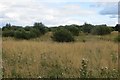
6
Undeveloped Land near Sourlie
I expect it will soon be built up as there are housing developments all around this area.
Image: © wfmillar
Taken: 15 Sep 2010
0.24 miles
7
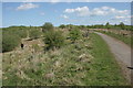
Path to the standing stones, Eglinton Country Park
The stones are just visible on the horizon.
Image: © Richard Sutcliffe
Taken: 14 May 2016
0.24 miles