IMAGES TAKEN NEAR TO
Barra Wynd, IRVINE, KA11 1DB
Introduction
This page details the photographs taken nearby to Barra Wynd, KA11 1DB by members of the Geograph project.
The Geograph project started in 2005 with the aim of publishing, organising and preserving representative images for every square kilometre of Great Britain, Ireland and the Isle of Man.

There are currently over 7.5m images from over14,400 individuals and you can help contribute to the project by visiting https://www.geograph.org.uk
Image Map
Images are licensed for reuse under creativecommons.org/licenses/by-sa/2.0
Notes
- Clicking on the map will re-center to the selected point.
- The higher the marker number, the further away the image location is from the centre of the postcode.
Image Listing (91 Images Found)
Images are licensed for reuse under creativecommons.org/licenses/by-sa/2.0
Image
Details
Distance
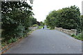
1
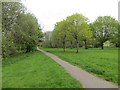
Cycle path, Irvine
Running through parkland.
Image: © Richard Webb
Taken: 25 Apr 2014
0.09 miles


7
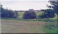
Site of Dreghorn station, 1994
View SE on Station Brae, towards Crosshouse (to left): ex-G&SWR Irvine - Crosshouse line, all closed 6/4/64.
Image: © Ben Brooksbank
Taken: 21 Jun 1994
0.13 miles