IMAGES TAKEN NEAR TO
The Grove, Monktonhill Road, TROON, KA10 7FX
Introduction
This page details the photographs taken nearby to The Grove, Monktonhill Road, KA10 7FX by members of the Geograph project.
The Geograph project started in 2005 with the aim of publishing, organising and preserving representative images for every square kilometre of Great Britain, Ireland and the Isle of Man.

There are currently over 7.5m images from over14,400 individuals and you can help contribute to the project by visiting https://www.geograph.org.uk
Image Map
Images are licensed for reuse under creativecommons.org/licenses/by-sa/2.0
Notes
- Clicking on the map will re-center to the selected point.
- The higher the marker number, the further away the image location is from the centre of the postcode.
Image Listing (27 Images Found)
Images are licensed for reuse under creativecommons.org/licenses/by-sa/2.0
Image
Details
Distance

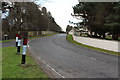
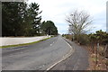
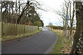
4
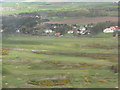
Royal Troon Golf Club
Looking northeast on approach to Prestwick, with the Glasgow-Ayr railway and the B749 Troon to Monkton road beyond.
Image: © M J Richardson
Taken: 29 Apr 2012
0.17 miles
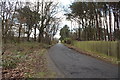
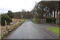
7
Isle of Pin Road near Fullarton House
Image: © Billy McCrorie
Taken: 29 Jan 2014
0.18 miles