IMAGES TAKEN NEAR TO
Whins Road, TROON, KA10 6UE
Introduction
This page details the photographs taken nearby to Whins Road, KA10 6UE by members of the Geograph project.
The Geograph project started in 2005 with the aim of publishing, organising and preserving representative images for every square kilometre of Great Britain, Ireland and the Isle of Man.

There are currently over 7.5m images from over14,400 individuals and you can help contribute to the project by visiting https://www.geograph.org.uk
Image Map
Images are licensed for reuse under creativecommons.org/licenses/by-sa/2.0
Notes
- Clicking on the map will re-center to the selected point.
- The higher the marker number, the further away the image location is from the centre of the postcode.
Image Listing (56 Images Found)
Images are licensed for reuse under creativecommons.org/licenses/by-sa/2.0
Image
Details
Distance
1
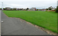
Goatfell View
The rear of houses on Goatfell View, viewed from Hillhouse Road.
Image: © Thomas Nugent
Taken: 6 Aug 2018
0.10 miles
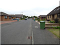
2
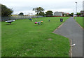
Swingpark off Hillhouse Road
By the path leading to Whins Road.
Image: © Thomas Nugent
Taken: 6 Aug 2018
0.11 miles
3
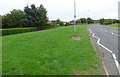
Kilmarnock Road
A narrow band of greenbelt alongside the suburban road which surprisingly has a 40 mph speed limit
Image: © Thomas Nugent
Taken: 6 Aug 2018
0.13 miles
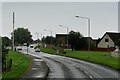
4
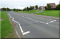
Kilmarnock Road
The B746, looking towards the A759 and A78.
Image: © Thomas Nugent
Taken: 6 Aug 2018
0.14 miles
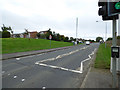
5
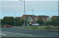
Pedestrian Traffic Lights on Kilmarnock Road
Image: © David Dixon
Taken: 25 Sep 2019
0.14 miles
6
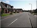
Links Crescent
New houses on former links land in Barassie.
Image: © Richard Webb
Taken: 9 Sep 2009
0.14 miles
7
Kilmarnock Road
Also known as the B746.
Image: © Thomas Nugent
Taken: 6 Aug 2018
0.14 miles
8
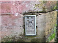
Ordnance Survey Flush Bracket G4332
This can be found on the wall of the buttress of the Railway Bridge at Brassie.
For more detail see : http://www.bench-marks.org.uk/bm17385
Image: © Peter Wood
Taken: 13 Sep 2016
0.17 miles
9
Links Crescent
Sandwiched between golf courses near Barassie railway station.
Image: © Thomas Nugent
Taken: 6 Aug 2018
0.17 miles
10
A junction on Kilmarnock Road
The road junction is between Kilmarnock Road and Deveron Road.
Image: © Malcolm Neal
Taken: 20 Sep 2022
0.17 miles