IMAGES TAKEN NEAR TO
MUIR OF ORD, IV6 7TN
Introduction
This page details the photographs taken nearby to IV6 7TN by members of the Geograph project.
The Geograph project started in 2005 with the aim of publishing, organising and preserving representative images for every square kilometre of Great Britain, Ireland and the Isle of Man.

There are currently over 7.5m images from over14,400 individuals and you can help contribute to the project by visiting https://www.geograph.org.uk
Image Map (Loading...)


Getting Data...Please wait
Leaflet Map data © OpenStreetMap
Images are licensed for reuse under creativecommons.org/licenses/by-sa/2.0
Notes
- Clicking on the map will re-center to the selected point.
- The higher the marker number, the further away the image location is from the centre of the postcode.
Image Listing (12 Images Found)
Images are licensed for reuse under creativecommons.org/licenses/by-sa/2.0
Image
Details
Distance
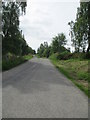
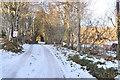
1
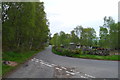
The road from Corry of Ardnagrask joining the road to Muir of Ord
Image: © Tim Heaton
Taken: 11 May 2018
0.09 miles
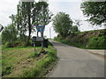
3
Cul-de-sac to Upper Aultvaich
Aultvaich translates to 'burn of the byre'. Nearby on the map is a burn - 'Ault a Bhathaich' - phonetically similar? Gaelic does not have a letter V but Bh produces a similar sound (http://www.houseofscotland.org/pronunciation).
Image: © Stuart Logan
Taken: 4 Jun 2011
0.10 miles
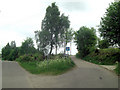
4
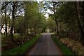
The Way to Ord Hill
Minor road heading west to serve the isolated and scattered dwellings that comprise Corry of Ardnagrask
Image: © Chris Heaton
Taken: 11 May 2018
0.10 miles
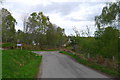
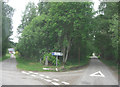
7
Access to Corry of Ardnagrask from Corrie Road
The cul-de-sac leads to a natural bowl at the start of the high ground further West. A corrie is a cirque in geology but the Gaelic word 'coire' can also mean cauldron or hollow.
Image: © Stuart Logan
Taken: 4 Jun 2011
0.16 miles
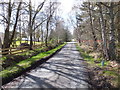
10
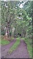
Track through woodland at Dungrianach
Image: © Alpin Stewart
Taken: 4 Aug 2017
0.17 miles