IMAGES TAKEN NEAR TO
Drumnadrochit, INVERNESS, IV63 6XT
Introduction
This page details the photographs taken nearby to IV63 6XT by members of the Geograph project.
The Geograph project started in 2005 with the aim of publishing, organising and preserving representative images for every square kilometre of Great Britain, Ireland and the Isle of Man.

There are currently over 7.5m images from over14,400 individuals and you can help contribute to the project by visiting https://www.geograph.org.uk
Image Map (Loading...)


Getting Data...Please wait
Leaflet Map data © OpenStreetMap
Images are licensed for reuse under creativecommons.org/licenses/by-sa/2.0
Notes
- Clicking on the map will re-center to the selected point.
- The higher the marker number, the further away the image location is from the centre of the postcode.
Image Listing (7 Images Found)
Images are licensed for reuse under creativecommons.org/licenses/by-sa/2.0
Image
Details
Distance
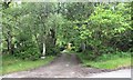
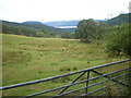
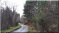
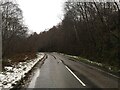
3
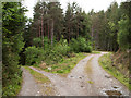
Forking of forest road at Rychraggan
A minor road climbs steeply north from the A831 in Glen Urquhart; in the vicinity of Rychraggan a forest road leaves it to the south, branching immediately.
Image: © Trevor Littlewood
Taken: 25 May 2011
0.15 miles