IMAGES TAKEN NEAR TO
FORRES, IV36 2ST
Introduction
This page details the photographs taken nearby to IV36 2ST by members of the Geograph project.
The Geograph project started in 2005 with the aim of publishing, organising and preserving representative images for every square kilometre of Great Britain, Ireland and the Isle of Man.

There are currently over 7.5m images from over14,400 individuals and you can help contribute to the project by visiting https://www.geograph.org.uk
Image Map (Loading...)


Getting Data...Please wait
Leaflet Map data © OpenStreetMap
Images are licensed for reuse under creativecommons.org/licenses/by-sa/2.0
Notes
- Clicking on the map will re-center to the selected point.
- The higher the marker number, the further away the image location is from the centre of the postcode.
Image Listing (10 Images Found)
Images are licensed for reuse under creativecommons.org/licenses/by-sa/2.0
Image
Details
Distance
1
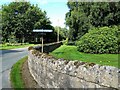
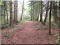
This Way for the Tearie Walks
Although the small car park lies a little to the north-west, walkers enter the estate in the Berryley direction for the Tearie Walks.
Image: © Mary and Angus Hogg
Taken: 6 Aug 2012
0.05 miles
2
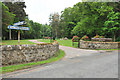
Entrance road for the estate office
Part of Moray Estates Development Company
Image: © Steven Brown
Taken: 6 Jun 2010
0.05 miles
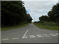
3
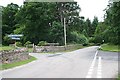
Road junction 2km north of Darnaway Castle.
Image: © Des Colhoun
Taken: 12 Jul 2006
0.06 miles
4
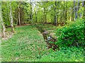
Darnaway Forest
Small burn on the edge of the forest by Tearie Lodge
Image: © valenta
Taken: 7 May 2018
0.06 miles
5
Part of one of the waymarked Tearie Walks footpaths
Looking north-westward.
Image: © Peter Wood
Taken: 12 May 2022
0.07 miles
7
Unclassified road near East Lodge, Darnaway
Image: © Douglas Nelson
Taken: 23 Aug 2023
0.19 miles
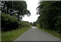
8
Private road to Moray Estates
A private road, so public access by car is not allowed, but a car parking area is provided just outside the estate boundary at NH990567 for walkers and cyclists
Image: © valenta
Taken: 7 May 2018
0.21 miles
9
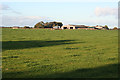
Tearie Farm
One of the large farms on Darnaway Estate. From 1982 to 1996 the buildings housed the Darnaway Estate visitor centre, incorporting an interesting agricultural museum, but this was closed in 1996 and a variety of enterprises has occupied the premises since then.
Image: © Anne Burgess
Taken: 11 Oct 2011
0.21 miles
10
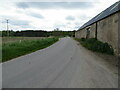
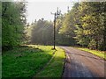
Minor road at Tearie Farm
Looking south-eastward.
Image: © Peter Wood
Taken: 12 May 2022
0.23 miles