IMAGES TAKEN NEAR TO
The Wards, FOCHABERS, IV32 7RB

Introduction

This page details the photographs taken nearby to The Wards, IV32 7RB by members of the Geograph project.

The Geograph project started in 2005 with the aim of publishing, organising and preserving representative images for every square kilometre of Great Britain, Ireland and the Isle of Man.

There are currently over 7.5m images from over14,400 individuals and you can help contribute to the project by visiting https://www.geograph.org.uk

Image Map


Images are licensed for reuse under creativecommons.org/licenses/by-sa/2.0
Notes
  • Clicking on the map will re-center to the selected point.
  • The higher the marker number, the further away the image location is from the centre of the postcode.

Image Listing (46 Images Found)

Images are licensed for reuse under creativecommons.org/licenses/by-sa/2.0
  • ...
Image
Details
Distance
1
Oriental Poppy (Papaver pseudoorientale)
As its name suggests, this showy plant is not native to Britain, but it certainly makes a bright contrast with the green around it. The white flowers are Aegopodium podagraria, better known to gardeners as Ground Elder or Bishopweed.
Image: © Anne Burgess Taken: 15 Jun 2020
0.11 miles
2
Burnside
Burnside is a Category B Listed house dating from 1831. See http://portal.historicenvironment.scot/designation/LB14844 for more detail.
Image: © Anne Burgess Taken: 4 Mar 2021
0.12 miles
3
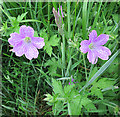
Geranium
This is probably G x oxonianum, which is a hybrid between French Cranesbill (G endressii) and Pencilled Cranesbill (G versicolor). The hybrid is commoner than either parent. All are non-native.
Image: © Anne Burgess Taken: 15 Jun 2020
0.12 miles
4
Kingston-on-Spey
The view from the footpath past the water tower, standing stones and trig point.
Image: © Anne Burgess Taken: 24 Apr 2021
0.14 miles
5
The Bow
A pend gives access to the garden and the front of the house, which backs on to Lein Road.
Image: © Anne Burgess Taken: 4 Mar 2021
0.17 miles
6
Lein Road
The stone houses in a row that back on to Lein Road are all Category C Liste buildings. The nearest is Sunnybank. then The Yews and (hidden by the Yews) Morven. The fronts of the houses face south, with gardens stretching down to the burn.
Image: © Anne Burgess Taken: 4 Mar 2021
0.17 miles
7
A Fence Post with a Difference
This smiling face greets visitors arriving in Kingston by the path from Garmouth.
Image: © Anne Burgess Taken: 24 Apr 2021
0.17 miles
8
Waymark near Garmouth
One of the waymarks on the path network. This one, near Garmouth, overlooks Kingston, at the mouth of the River Spey.
Image: © Anne Burgess Taken: 11 May 2016
0.17 miles
9
Morven
This is the furthest east of the three Category C Listed houses on the south side of Lein Road. Like Sunnybank and The Yews, the front faces south and it has a garden extending to the burn.
Image: © Anne Burgess Taken: 4 Mar 2021
0.17 miles
10
Millbank
The house dates from 1826 and is a Category B Listed building. See http://portal.historicenvironment.scot/designation/LB14867 for details.
Image: © Anne Burgess Taken: 4 Mar 2021
0.17 miles
  • ...