IMAGES TAKEN NEAR TO
Skye Court, IV2 7BJ
Introduction
This page details the photographs taken nearby to Skye Court, IV2 7BJ by members of the Geograph project.
The Geograph project started in 2005 with the aim of publishing, organising and preserving representative images for every square kilometre of Great Britain, Ireland and the Isle of Man.

There are currently over 7.5m images from over14,400 individuals and you can help contribute to the project by visiting https://www.geograph.org.uk
Image Map (Loading...)


Getting Data...Please wait
Leaflet Map data © OpenStreetMap
Images are licensed for reuse under creativecommons.org/licenses/by-sa/2.0
Notes
- Clicking on the map will re-center to the selected point.
- The higher the marker number, the further away the image location is from the centre of the postcode.
Image Listing (9 Images Found)
Images are licensed for reuse under creativecommons.org/licenses/by-sa/2.0
Image
Details
Distance
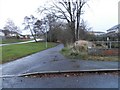
1
Field at Ashton Farm
Kessock Bridge can be seen in the background. Compare with the earlier photo at http://www.geograph.org.uk/photo/345458
Image: © don cload
Taken: 25 Jul 2010
0.16 miles
2
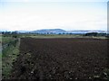
Field at Ashton Farm
Recently ploughed field exposing how stony the soil is.
Looking towards the Moray Firth.
Image: © John Allan
Taken: 20 Feb 2007
0.17 miles
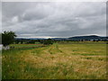
3
Fields, by Ashton Farm
Looking towards houses on the edge of the suburbs, around Resaurie and Smithton.
Image: © Craig Wallace
Taken: 22 Jun 2021
0.17 miles
5
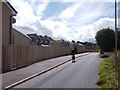
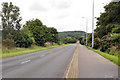
Caulfield Road North
New houses in suburban Inverness, with fields to the right. The road is blocked to cars by a gate under the railway bridge.
Image: © Richard Webb
Taken: 4 Aug 2015
0.20 miles
6
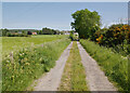
Track, by Ashton Farm
A track from Ashton Farm towards the edge of the suburbs at Resaurie.
Image: © Craig Wallace
Taken: 22 Jun 2021
0.21 miles
7
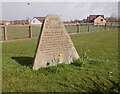
Shackleton Park, Smithton
A small grassy area amongst the housing estates.
As it says on the stone:
This park is named in memory of the Shackleton Bomber of 120 Sqn Coastal Command that crash landed near this site on 10th January 1964. It commemorates the heroism and skill that saved both the community and crew from disaster.
An article from the Press & Journal. https://www.pressandjournal.co.uk/fp/news/inverness/1097472/crash-site-history-restored/
Image: © Craig Wallace
Taken: 9 Apr 2021
0.21 miles
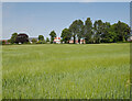
8
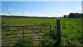
Gate and fields at Stratton Farm, Inverness
Image: © Alpin Stewart
Taken: 14 May 2017
0.23 miles