IMAGES TAKEN NEAR TO
Leanach Gardens, INVERNESS, IV2 5DD
Introduction
This page details the photographs taken nearby to Leanach Gardens, IV2 5DD by members of the Geograph project.
The Geograph project started in 2005 with the aim of publishing, organising and preserving representative images for every square kilometre of Great Britain, Ireland and the Isle of Man.

There are currently over 7.5m images from over14,400 individuals and you can help contribute to the project by visiting https://www.geograph.org.uk
Image Map
Images are licensed for reuse under creativecommons.org/licenses/by-sa/2.0
Notes
- Clicking on the map will re-center to the selected point.
- The higher the marker number, the further away the image location is from the centre of the postcode.
Image Listing (7 Images Found)
Images are licensed for reuse under creativecommons.org/licenses/by-sa/2.0
Image
Details
Distance
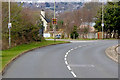
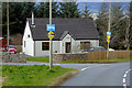
1
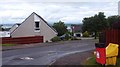
Leanach Gardens, Westhill
Suburb of Inverness.
Image: © Richard Webb
Taken: 4 Aug 2015
0.04 miles
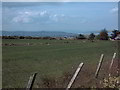
2
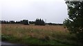
Field, Easter Muckovie
The current edge of Inverness, if Inverness could be said to have an edge, as ribbon development has affected at least a 50km radius. The suburb of Westhill has yet to jump the B9006 here.
Image: © Richard Webb
Taken: 4 Aug 2015
0.08 miles