IMAGES TAKEN NEAR TO
Evelix, DORNOCH, IV25 3NG
Introduction
This page details the photographs taken nearby to IV25 3NG by members of the Geograph project.
The Geograph project started in 2005 with the aim of publishing, organising and preserving representative images for every square kilometre of Great Britain, Ireland and the Isle of Man.

There are currently over 7.5m images from over14,400 individuals and you can help contribute to the project by visiting https://www.geograph.org.uk
Image Map
Images are licensed for reuse under creativecommons.org/licenses/by-sa/2.0
Notes
- Clicking on the map will re-center to the selected point.
- The higher the marker number, the further away the image location is from the centre of the postcode.
Image Listing (9 Images Found)
Images are licensed for reuse under creativecommons.org/licenses/by-sa/2.0
Image
Details
Distance
1
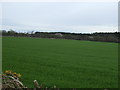
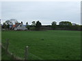
Apple Orchard at Milltown of Evelix
Track leads of beside Garage on A9 to Milltown of Evelix. There are several old Buildings.
Image: © Sarah McGuire
Taken: 22 May 2008
0.09 miles
2
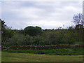
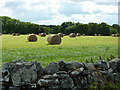
Boundary Wall of Milltown of Evelix
The wood in Background is the Eastern boundary of the Clashmore Wood. If you zoom in you can see a deer in front of the whins bush in front of wall.
Image: © Sarah McGuire
Taken: 22 May 2008
0.09 miles
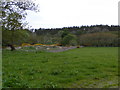
6
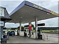
Petrol station
On the A9 at Milltown of Evelix
Image: © Graham Hogg
Taken: 7 Jun 2021
0.23 miles
7
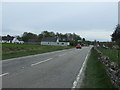
A9 heading south, Milltown of Evelix
Towards Tain.
Image: © JThomas
Taken: 3 May 2014
0.23 miles
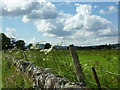
8
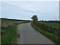
Minor road towards the A9, Evelix
Heading east.
Image: © JThomas
Taken: 3 May 2014
0.24 miles