1
Inverness : Highland Council Headquarters
Seen from Glenurquhart Road.
Image: © Lewis Clarke
Taken: 24 Apr 2016
0.02 miles
2
Glenurquhart Road (A82)
The A82, Glenurquhart Road, passing the Highland Council Offices at Inverness.
Image: © David Dixon
Taken: 4 Apr 2017
0.02 miles
3
Debating Chamber, The Highland Council
I made a fair few speeches in there in previous times!
Image: © David Bremner
Taken: 12 Sep 2021
0.03 miles
4
Inverness : Highland Council Headquarters
The council's administrative headquarters on Glenurquhart Road.
Image: © Lewis Clarke
Taken: 24 Apr 2016
0.03 miles
5
Inverness : Highland Council Headquarters
The council building seen on Glenurquhart Road.
Image: © Lewis Clarke
Taken: 24 Apr 2016
0.04 miles
6
The Knocknagael Boarstone
Known as a Class 1 Pictish Stone, the Knocknagael Boarstone was removed from its original site by Historic Scotland, to the foyer of the Highland Council chambers. It’s accessible to the public via a buzzer system. Believed to have been carved about 700-800 AD, and standing about six feet high, the stone is well worth a visit.
Image: © valenta
Taken: 9 May 2016
0.04 miles
7
Council Building
Part of the old buildings containing the Highland Regional Council.
Image: © don cload
Taken: 26 Oct 2009
0.04 miles
8
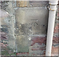
OS Cut Mark, Inverness, Glenurquhart Road
OS Cut Mark, Inverness, Glenurquhart Road
B01445 CUT MARK: COUNTY BLDGS SE SIDE GLENURQUHART RD N ANG NW FACE (ODN 6.8013m, AGL 0.7m).
Now part of Highland Council HQ, Inverness
Image: © thejackrustles
Taken: 14 Oct 2014
0.04 miles
9
OS Cut Mark, Inverness, Glenurquhart Road
OS Cut Mark, Inverness, Glenurquhart Road
B01445 CUT MARK: COUNTY BLDGS SE SIDE GLENURQUHART RD N ANG NW FACE (ODN 6.8013m, AGL 0.7m).
Now part of Highland Council HQ, Inverness
Image: © thejackrustles
Taken: 14 Oct 2014
0.04 miles
10
Knocknagael Boar Stone
A large Pictish stone with the symbols of a mirror case and a wild boar. Being badly weathered, the carvings are easier to make out on site than in the photo. The stone is now safely under cover and on display in Highland Council's HQ, in partnership with Historic Scotland.
Image: © Mary and Angus Hogg
Taken: 26 Mar 2015
0.04 miles


