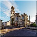
IMAGES TAKEN NEAR TO
Scotsburn Road, TAIN, IV19 1PP

Introduction

This page details the photographs taken nearby to Scotsburn Road, IV19 1PP by members of the Geograph project.

The Geograph project started in 2005 with the aim of publishing, organising and preserving representative images for every square kilometre of Great Britain, Ireland and the Isle of Man.

There are currently over 7.5m images from over14,400 individuals and you can help contribute to the project by visiting https://www.geograph.org.uk

Image Map


Images are licensed for reuse under creativecommons.org/licenses/by-sa/2.0
Notes
  • Clicking on the map will re-center to the selected point.
  • The higher the marker number, the further away the image location is from the centre of the postcode.

Image Listing (255 Images Found)

Images are licensed for reuse under creativecommons.org/licenses/by-sa/2.0
  • ...
Image
Details
Distance
1
Bottom End of Scotsburn Road in Tain
Image: © Chris Heaton Taken: 13 May 2018
0.02 miles
2
Tain Free Church of Scotland
Category B listed from 1891/2
Image: © valenta Taken: 17 Feb 2018
0.02 miles
3
Stagecoach bus garage, Tain, 1998
Visited in the course of a double-deck bus journey from Inverness to Brora. Although the 25X was advertised as a through service, it involved a change of bus at the small depot in Tain. The friend I was with had set himself a challenge to ride on a double deck bus continuously between John O'Groats and Lands End (not all in one go!). Brora was one end of a gap between there and Thurso or Wick without a scheduled double-deck service, and I don't know whether he ever managed to achieve his goal. Stagecoach 'Bluebird' no.028, the bus on which we were travelling, is a Volvo Olympian with Northern Counties bodywork, new in 1993. Bus 059 on the left is a Leyland Olympian with Alexander bodywork, new to Alexander Northern (the predecessor of Stagecoach in the area) in 1985.
Image: © Alan Murray-Rust Taken: 16 Jun 1998
0.03 miles
4
Tain Parish Church, Queen Street, Tain
A Category B listed church, dating from 1891-92 [http://portal.historicenvironment.scot/designation/LB41895]. Formerly Tain Free Church.
Image: © Richard Sutcliffe Taken: 20 Sep 2017
0.03 miles
5
Entrance, Tain Parish Church
Door to the Category B listed church, dating from 1891-92 [http://portal.historicenvironment.scot/designation/LB41895]. Formerly Tain Free Church.
Image: © Richard Sutcliffe Taken: 20 Sep 2017
0.03 miles
6
Tain Parish Church, Queen Street, Tain
Image: © Ian S Taken: 19 Jun 2018
0.03 miles
7
Access road beside Tain Parish Church
Image: © JThomas Taken: 8 May 2014
0.03 miles
8
Tain Free Church
Built in 1938, Tain Free Church is located in Scotsburn Road.
Image: © Mary and Angus Hogg Taken: 25 Feb 2014
0.03 miles
9
Tain Parish Church
Image: © JThomas Taken: 8 May 2014
0.04 miles
10
Tain Parish Church of Scotland
Queen Street, Tain
Image: © wfmillar Taken: 21 Jun 2019
0.04 miles
  • ...