IMAGES TAKEN NEAR TO
Robbins Court, NAIRN, IV12 5PL
Introduction
This page details the photographs taken nearby to Robbins Court, IV12 5PL by members of the Geograph project.
The Geograph project started in 2005 with the aim of publishing, organising and preserving representative images for every square kilometre of Great Britain, Ireland and the Isle of Man.

There are currently over 7.5m images from over14,400 individuals and you can help contribute to the project by visiting https://www.geograph.org.uk
Image Map
Images are licensed for reuse under creativecommons.org/licenses/by-sa/2.0
Notes
- Clicking on the map will re-center to the selected point.
- The higher the marker number, the further away the image location is from the centre of the postcode.
Image Listing (16 Images Found)
Images are licensed for reuse under creativecommons.org/licenses/by-sa/2.0
Image
Details
Distance
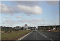
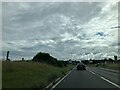
1
The A96 on western outskirts of Nairn
Image: © Douglas Nelson
Taken: 9 Dec 2020
0.04 miles
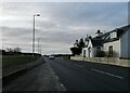
2
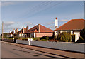
Sandown Road
A row of mid-20th century bungalows on the southern part of Sandown Road.
Image: © Anne Burgess
Taken: 24 Feb 2012
0.12 miles
3
Junction of Sandown Road, Nairn and A96
Image: © Alpin Stewart
Taken: 30 Jul 2016
0.13 miles
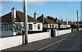
5
Bungalows on the east side of Sandown Road
Image: © Ian R Maxwell
Taken: 7 Oct 2006
0.17 miles
7
Site of the Tradespark Hall (demolished)
The local community hall was sited close to Sandown Road, Tradespark.
Image: © Ian R Maxwell
Taken: 7 Oct 2006
0.18 miles
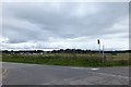
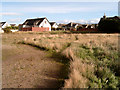
8
Field off Sandown Road
The houses in the background are on Tradespark Road.
Image: © Anne Burgess
Taken: 24 Feb 2012
0.19 miles
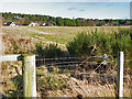
9
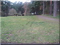
Woodland path and picnic area on outskirts of Nairn
Image: © Douglas Nelson
Taken: 12 Mar 2020
0.22 miles
10
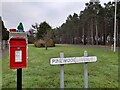
Postbox and Street Sign
IV12 8. Royal Mail list this box as 'Pinewood Avenue'.
Image: © David Bremner
Taken: 19 Dec 2021
0.22 miles