IMAGES TAKEN NEAR TO
NAIRN, IV12 5HY
Introduction
This page details the photographs taken nearby to IV12 5HY by members of the Geograph project.
The Geograph project started in 2005 with the aim of publishing, organising and preserving representative images for every square kilometre of Great Britain, Ireland and the Isle of Man.

There are currently over 7.5m images from over14,400 individuals and you can help contribute to the project by visiting https://www.geograph.org.uk
Image Map (Loading...)


Getting Data...Please wait
Leaflet Map data © OpenStreetMap
Images are licensed for reuse under creativecommons.org/licenses/by-sa/2.0
Notes
- Clicking on the map will re-center to the selected point.
- The higher the marker number, the further away the image location is from the centre of the postcode.
Image Listing (6 Images Found)
Images are licensed for reuse under creativecommons.org/licenses/by-sa/2.0
Image
Details
Distance
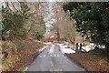
4
Farm track
Track from Craggie Farm to Dalmore, overlooking the fishing lakes on the farm
Image: © valenta
Taken: 16 Jan 2020
0.20 miles
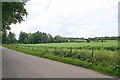
5
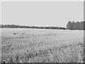
Barley, Newmill
Arable land near Auldearn.
Image: © Richard Webb
Taken: 24 Aug 2021
0.21 miles
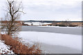
6
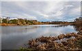
Lakes on Craggie Farm
Relatively modern man-made lakes that are stocked with game fish. Part of Craggie farm, they are adjacent to the Grigorhill to Newmill Road
Image: © valenta
Taken: 16 Jan 2020
0.24 miles