
IMAGES TAKEN NEAR TO
Holly Lane, IPSWICH, IP9 2SU
Introduction
This page details the photographs taken nearby to Holly Lane, IP9 2SU by members of the Geograph project.
The Geograph project started in 2005 with the aim of publishing, organising and preserving representative images for every square kilometre of Great Britain, Ireland and the Isle of Man.

There are currently over 7.5m images from over14,400 individuals and you can help contribute to the project by visiting https://www.geograph.org.uk
Image Map
Images are licensed for reuse under creativecommons.org/licenses/by-sa/2.0
Notes
- Clicking on the map will re-center to the selected point.
- The higher the marker number, the further away the image location is from the centre of the postcode.
Image Listing (15 Images Found)
Images are licensed for reuse under creativecommons.org/licenses/by-sa/2.0
Image
Details
Distance
2
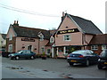
Kings Head Stutton
Kings Head public house Stutton Suffolk.
Image: © Keith Evans
Taken: 24 Feb 2007
0.22 miles
3

Bentley Lane
From Stutton towards Bentley.
Image: © Robin Webster
Taken: 26 Nov 2017
0.22 miles
5
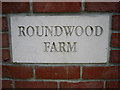
Smart new entrance to Roundwood Farm
Right next to a bridle way, this seems to be a new access to Roundwood Farm, which is shown on the map as further north-west. Not a cheap sign but a smart piece of stone lettering!
Image: © Zorba the Geek
Taken: 18 Jul 2007
0.23 miles
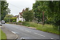
8
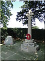
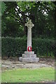
Stutton War Memorial beside Manningtree Road.
http://www.geograph.org.uk/photo/5519597
Image: © Adrian S Pye
Taken: 31 Aug 2017
0.23 miles
9
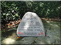
Addendum to Stutton War Memorial
There are no names on Stutton War Memorial so the names have been inscribed on this granite boulder which stands beside the memorial cross.
Image: © Adrian S Pye
Taken: 31 Aug 2017
0.23 miles
10
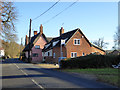
Cottages, Manningtree Road, Stutton
Chapel Cottage, with the thatch, is a grade II listed building, 16th century or earlier.
Image: © Robin Webster
Taken: 26 Nov 2017
0.23 miles