IMAGES TAKEN NEAR TO
Bentley, IPSWICH, IP9 2LT
Introduction
This page details the photographs taken nearby to IP9 2LT by members of the Geograph project.
The Geograph project started in 2005 with the aim of publishing, organising and preserving representative images for every square kilometre of Great Britain, Ireland and the Isle of Man.

There are currently over 7.5m images from over14,400 individuals and you can help contribute to the project by visiting https://www.geograph.org.uk
Image Map
Images are licensed for reuse under creativecommons.org/licenses/by-sa/2.0
Notes
- Clicking on the map will re-center to the selected point.
- The higher the marker number, the further away the image location is from the centre of the postcode.
Image Listing (12 Images Found)
Images are licensed for reuse under creativecommons.org/licenses/by-sa/2.0
Image
Details
Distance
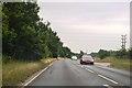
1
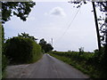
Road at Malting Farm
Looking towards the A137
Image: © Geographer
Taken: 14 Jun 2013
0.05 miles
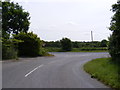
4
Footpath to Church Road
Near Malting House
Image: © Geographer
Taken: 14 Jun 2013
0.11 miles
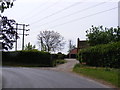
5
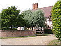
Malting House
Near the footpath to Church Road
Image: © Geographer
Taken: 14 Jun 2013
0.12 miles
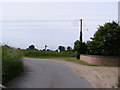
9
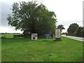
Farm Shop Signs
Farm shop sign next to the A.137 near to Tattingstone, Suffolk.
Image: © Keith Evans
Taken: 27 Oct 2013
0.19 miles
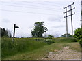
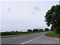
10
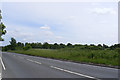
A137 looking towards Ipswich & footpaths
Image: © Geographer
Taken: 14 Jun 2013
0.19 miles