
IMAGES TAKEN NEAR TO
Shotley, IPSWICH, IP9 1ET
Introduction
This page details the photographs taken nearby to IP9 1ET by members of the Geograph project.
The Geograph project started in 2005 with the aim of publishing, organising and preserving representative images for every square kilometre of Great Britain, Ireland and the Isle of Man.

There are currently over 7.5m images from over14,400 individuals and you can help contribute to the project by visiting https://www.geograph.org.uk
Image Map
Images are licensed for reuse under creativecommons.org/licenses/by-sa/2.0
Notes
- Clicking on the map will re-center to the selected point.
- The higher the marker number, the further away the image location is from the centre of the postcode.
Image Listing (79 Images Found)
Images are licensed for reuse under creativecommons.org/licenses/by-sa/2.0
Image
Details
Distance
1
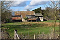
Barns at Old Hall, Shotley
The farm sits on the medieval moated site of Old Hall, now occupied by a more recent house and farm buildings.
Image: © Simon Mortimer
Taken: 10 Mar 2019
0.04 miles
2
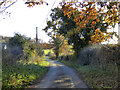
Oldhall Road, Shotley
From Shotley Church End towards Shotley and Shotley Gate.
Image: © Robin Webster
Taken: 26 Nov 2017
0.05 miles
4
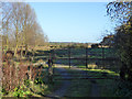
Gated track down to Shotley Marshes
A private route, well fenced against unauthorized access.
Image: © Robin Webster
Taken: 26 Nov 2017
0.09 miles
5
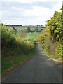
Oldhall Road
Looking north along Oldhall Road near to Shotley, Suffolk.
Image: © Keith Evans
Taken: 8 Nov 2009
0.09 miles
6
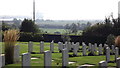
Naval cemetery at Shotley, Suffolk
The container terminal at Felixstowe can be seen in the far distance
Image: © John Welford
Taken: 28 Sep 2013
0.11 miles
7
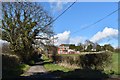
Approaching Shotley Church End from the south
Looking north along Oldhall Road. The a modern house from the 1970s dominates the view in front of St Mary's Church with its squat tower.
Image: © Simon Mortimer
Taken: 10 Mar 2019
0.12 miles
8
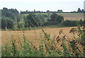
Fields west of Oldhall Road
Seen from Shotley walk in the next square north. Oldhall Road can be seen to the left of the picture, rising towards the B1456.
Image: © Andrew Hill
Taken: 29 Aug 2008
0.13 miles
9
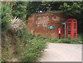
Church End telephone box and postbox
According to the 1:25,000 map, pretty much everything in view is in this square.
Image: © Andrew Hill
Taken: 29 Aug 2008
0.13 miles
10
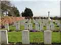
Shotley Royal Naval Cemetery and War Memorial
Image: © Adrian S Pye
Taken: 10 Apr 2015
0.13 miles