
IMAGES TAKEN NEAR TO
Needle Corner, IPSWICH, IP9 1BY
Introduction
This page details the photographs taken nearby to Needle Corner, IP9 1BY by members of the Geograph project.
The Geograph project started in 2005 with the aim of publishing, organising and preserving representative images for every square kilometre of Great Britain, Ireland and the Isle of Man.

There are currently over 7.5m images from over14,400 individuals and you can help contribute to the project by visiting https://www.geograph.org.uk
Image Map
Images are licensed for reuse under creativecommons.org/licenses/by-sa/2.0
Notes
- Clicking on the map will re-center to the selected point.
- The higher the marker number, the further away the image location is from the centre of the postcode.
Image Listing (9 Images Found)
Images are licensed for reuse under creativecommons.org/licenses/by-sa/2.0
Image
Details
Distance
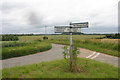
2
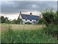
Sparrow Hall: abandoned listed building
This listed building has been at risk for some time. See http://www.britishlistedbuildings.co.uk/en-493412-sparrow-hall-harkstead and http://www.babergh-south-suffolk.gov.uk/Babergh/Home/Environment+and+Health/Conservation/Buildings+At+Risk.htm
Image: © Roger Jones
Taken: 19 Jul 2011
0.06 miles
3
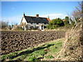
Sparrow Hall
A view of Sparrow Hall, abandoned and now derelict, taken from the footpath leading southwards past the remains of an old jetty > Image on the River Stour.
Image: © Evelyn Simak
Taken: 16 Jan 2008
0.08 miles
5
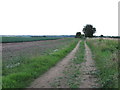
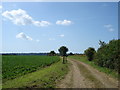
Track near Sparrow Hall
This footpath eventually leads down to the Stour
Image: © Roger Jones
Taken: 19 Jul 2011
0.11 miles
6
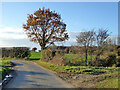
Small bridge and bend, lane towards Harkstead
Image: © Robin Webster
Taken: 26 Nov 2017
0.18 miles
7
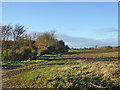
Fields along stream valley
Country east of Harkstead.
Image: © Robin Webster
Taken: 26 Nov 2017
0.20 miles
8
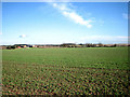
Undulating farmland
North of the River Stour.
Image: © Evelyn Simak
Taken: 16 Jan 2008
0.22 miles
9

The old Farmhouse - Knights Farm - The Street - Harkstead
Distinctive Farm House on a narrow country lane on the Shotley Peninsula in Suffolk. An area of outstanding beauty dating back to the time of Henry VIII and beyond. In 2021 the new buildings attempt to blend into the ancient countryside without much success. Drivers be warned, drive with care and be prepared to reverse to a passing place when meeting a vehicle head on at a blind bend.
Image: © Tony Peacock
Taken: 5 Jul 2021
0.23 miles