IMAGES TAKEN NEAR TO
Harkstead, IPSWICH, IP9 1BX
Introduction
This page details the photographs taken nearby to IP9 1BX by members of the Geograph project.
The Geograph project started in 2005 with the aim of publishing, organising and preserving representative images for every square kilometre of Great Britain, Ireland and the Isle of Man.

There are currently over 7.5m images from over14,400 individuals and you can help contribute to the project by visiting https://www.geograph.org.uk
Image Map
Images are licensed for reuse under creativecommons.org/licenses/by-sa/2.0
Notes
- Clicking on the map will re-center to the selected point.
- The higher the marker number, the further away the image location is from the centre of the postcode.
Image Listing (4 Images Found)
Images are licensed for reuse under creativecommons.org/licenses/by-sa/2.0
Image
Details
Distance
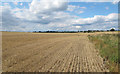
1
Footpath over arable land, near Nether Hall, Harkstead
Image: © Roger Jones
Taken: 14 Aug 2011
0.16 miles
2
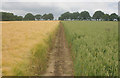
Suffolk Coast & Heath Path south-east of Harkstead
Barley on the left and wheat on the right.
Image: © David Kemp
Taken: 14 Jun 2014
0.16 miles
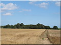
3

Harkstead snow fields
A wintery view of the gently undulating fields towards Nether Hall in Harkstead.
Image: © Simon Leatherdale
Taken: 19 Dec 2010
0.19 miles