
IMAGES TAKEN NEAR TO
Mannings Lane, IPSWICH, IP9 1AP
Introduction
This page details the photographs taken nearby to Mannings Lane, IP9 1AP by members of the Geograph project.
The Geograph project started in 2005 with the aim of publishing, organising and preserving representative images for every square kilometre of Great Britain, Ireland and the Isle of Man.

There are currently over 7.5m images from over14,400 individuals and you can help contribute to the project by visiting https://www.geograph.org.uk
Image Map
Images are licensed for reuse under creativecommons.org/licenses/by-sa/2.0
Notes
- Clicking on the map will re-center to the selected point.
- The higher the marker number, the further away the image location is from the centre of the postcode.
Image Listing (17 Images Found)
Images are licensed for reuse under creativecommons.org/licenses/by-sa/2.0
Image
Details
Distance
2
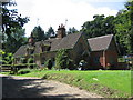
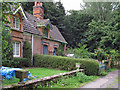
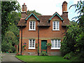
Cottage in a clearing
Sympathetically extended cottage in a clearing in Woolverstone Woods.
Image: © Alison Rawson
Taken: 21 Jul 2007
0.01 miles
3

Owl Sculpture near Deer Park Lodge
The owl is sculpted directly from the tree trunk is stands on.
Image: © Roger Jones
Taken: 28 Aug 2011
0.05 miles
4
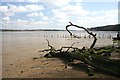
Dead tree on Orwell foreshore
Erosion of the banks has caused many trees, such as this, to collapse on to the silt on the river's foreshore.
Image: © Bob Jones
Taken: 15 Apr 2008
0.13 miles
5
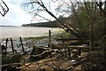
Cluttered Orwell foreshore
Amongst the clutter of dead trees and flotsam is a fence and stile, giving access along the west bank of the River Orwell. In the distance is Woolverstone Marina.
Image: © Bob Jones
Taken: 15 Apr 2008
0.14 miles
7
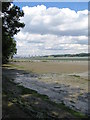
Foreshore at Woolverstone
Looking upstream from the end of the public footpath towards the Orwell Bridge.
Image: © Alison Rawson
Taken: 21 Jul 2007
0.16 miles
8
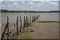
Old fence in the River Orwell
This old fence extends out to the low water mark. The dredged channel can be seen as a blue horizontal strip, as well as a red (port-hand) channel marker buoy on the extreme right of the photo.
Image: © Bob Jones
Taken: 15 Apr 2008
0.16 miles
9
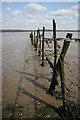
River Orwell fence
OK - it's an old fence. But what purpose did it once serve, other than to mark out someone's property? In days gone by, people who worked on the river's banks wore footwear akin to snow shoes, which prevented them from sinking into the treacherous mud.
Image: © Bob Jones
Taken: 15 Apr 2008
0.16 miles
10
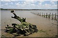
Old fence and tree stump
At low water the River Orwell is reduced to a narrow, but deep, strip in the centre of the estuary. The fence extends as far as the low water mark, whilst an old tree stump stubbornly refuses to drift away.
Image: © Bob Jones
Taken: 15 Apr 2008
0.17 miles